Context
Advance: 8.50 km²
Top Advance = 0.31km2, Middle Advance = 3.55km2, Bottom Advance = 4.64km2
The big news item today came from the Vuhledar front, with lots of footage from in and around the town itself as Ukrainian positions here finally collapsed.
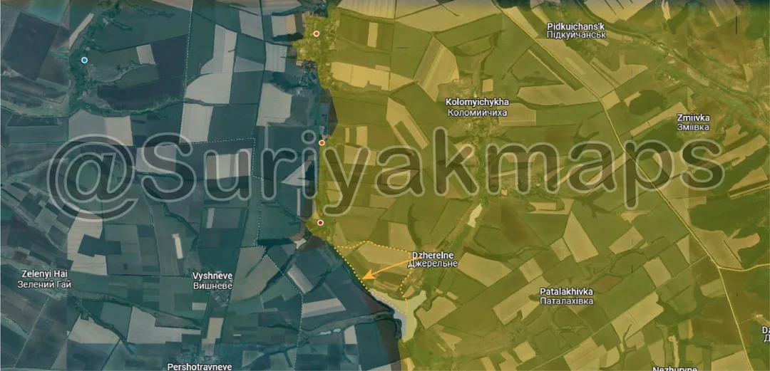
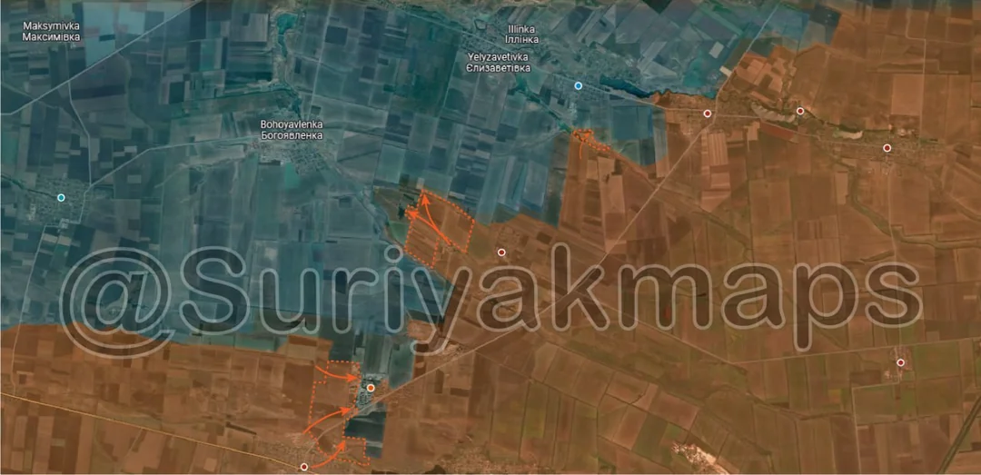
Starting off in the north, Russian troops continued advancing around Solodka River, capturing the treelines and part of the fields on the northern bank. When this direction of advance first began, I mentioned predicting Russia would use the River as a barrier to bypass Katerynivka (top blue dot) in order to attack Yelyzavetivka. This has only partially come true, as whilst they have used the river to bypass Ukrainian positions in the eastern fields, this advance suggests Russia intends to attack Katerynivka anyway, from the southern side. Whether this is the intention is not confirmed yet, so we will have to wait a few days for more information.
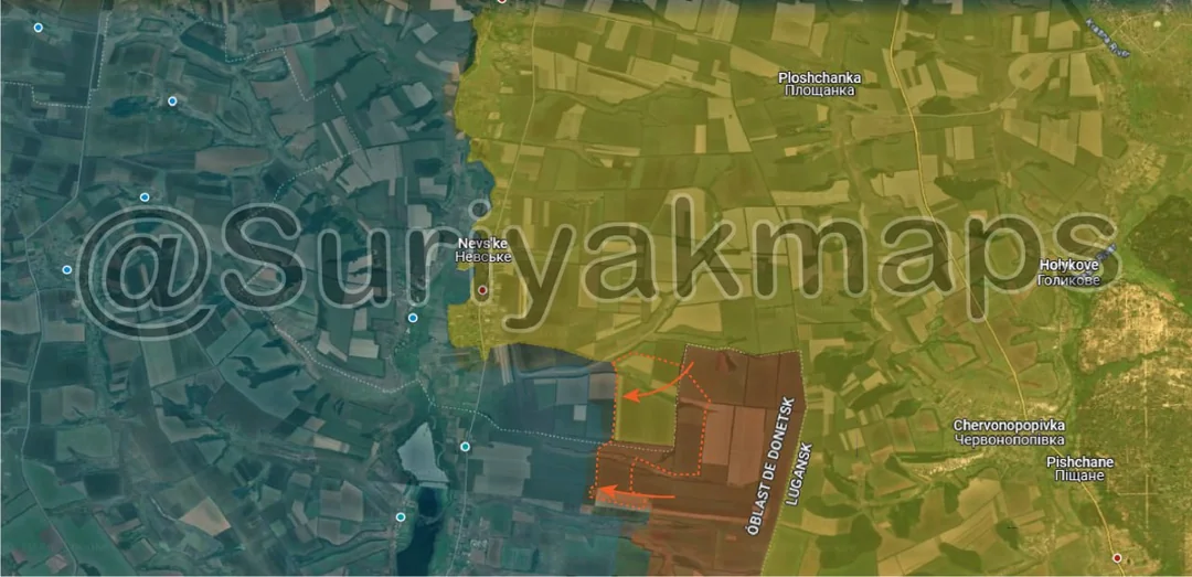
Southwest of here, Russian forces launched an attack from coal mine number 3, pushing out and capturing several fields and the large farm. Russian sources claimed this attack was even more successful, getting within 1.8km of Bohoyavlenka (i.e. advanced 1.45km further northwest than shown here), however this could not be confirmed just yet, hence why Suriyak has the map as shown. If this does end up being confirmed, it would mean Russia is quickly closing in on the town, and could start assaults within the week. This advance (the confirmed part) also has consequences for Ukrainian troops in Vuhledar, as it has meant the ones trying to retreat on foot need to travel even further around to avoid Russian positions and get to Bohoyavlenka.
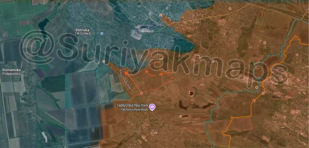
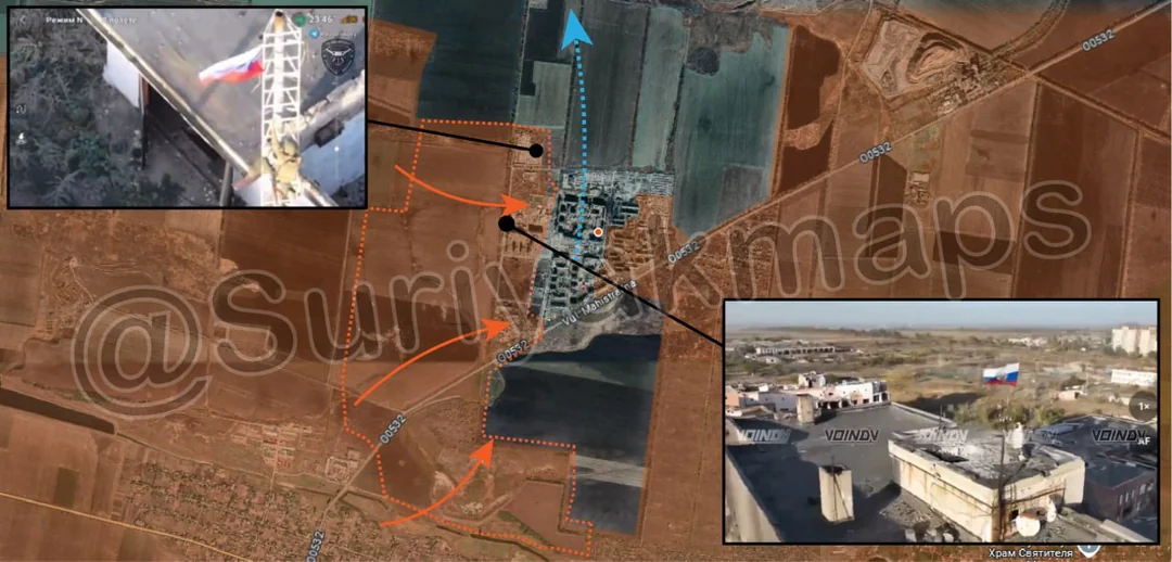
As for Vuhledar, as shown in Picture 6, Russian troops have advanced on the western side of the town, visually confirmed to have captured the outermost buildings on that side, as seen here and here. With most of the focus on the eastern side of the town, where Russia first established a foothold, Russian assault groups on the other side took advantage and pushed in from the west. Ukrainian sources reported their troops finally got the go ahead to try retreat from the town (as opposed to the mishmash of evacuation attempts and individual groups leaving of their own accord). Leaving it this late did not help the allegations that Zelensky wanted to hold the town at all costs until his U.S. visit was over in order to avoid the bad P.R., which I mentioned a few days ago.
Now as of writing this most of Vuhledar has confirmed to have been captured by Russia (not necessarily 100% cleared), however this occurred on the morning of Day 950, which I will cover in the next post. I would like to mention that I predict Vuhledar would fall within the next week exactly 6 days ago.
What I will talk about instead is the retreating Ukrainian troops. From the footage we have of the town and surrounding area, which I’ve linked in my updates over the past few weeks (here is another), Ukrainian troops were unable to properly evacuate from Vuhledar due to Russian fire control established over the remaining dirt paths north, with evacuation vehicles being hit, often before they even reached the town. This has meant the remaining Ukrainian troops had/have to retreat on foot, which is obviously much slower and more exposed to attack. From the snippets of information we have, Russian sources claim Ukraine was trying to move soldiers out of the town in groups of 2 or 3, with many not surviving the journey.
Specific numbers of Ukrainian troops who were captured/killed in Vuhledar, who surrendered, were killed retreating, or successfully escaped is unknown. My earlier predictions were about 500-1000 soldiers left in the pocket (partly the garrison, partly the soldiers who retreated back into Vuhledar from coal mine no.1, and the trenches south and west of the town). Whilst we may never know exactly what happened to them, the 72nd Mechanised Brigade, which held the town (not the only one), has been devastated, with their commander being dismissed a few days ago. Some sources go so far as to claim the 72nd is being disbanded due to losses, but I cannot confirm this information.
I’ll talk more about what happens next on this front in the next update, which will cover Vuhledar actually falling under Russian control.
-----------------------------------------------------------------------------------------------------------------
Total Russian Advance (Gross) = 27.40km2
For those that asked, Advances excluding Kursk:
Total Russian Advance (Gross) = 27.40km2
-----------------------------------------------------------------------------------------------------------------
Additional Point:
· Ukraine’s control of Kursk currently sits at 665.03km2. Ukraine’s maximum control in Kursk was approximately 930km2, short of their initial claim of 1000km2, and well below their revised claim of 1300km2.