Back home
Post #139

RU POV: Russian and Ukrainian advances from Day 1027 to 1030 of the War - Suriyakmaps

Dec 16, 2024 — Dec 19, 2024 War Day 1027–1030

Chunky update today, so strap in. There is a lot to talk about, with major developments on multiple fronts.

-------------------------------------------------------------------------------------------------------

Pictures 1 to 6 are from Day 1027 (Monday 16 December), pictures 7 to 11 are from Day 1028 (Tuesday 17 December), pictures 12 to 16 are from Day 1029 (Wednesday 18 December), and pictures 17 to 20 are from Day 1030 (Thursday 19 December).

-------------------------------------------------------------------------------------------------------

A reminder that these maps are confirming updates from previous days (i.e. 12 to 48 hours delayed from each day).

Ukrainian Advance
3.02 km²
Overall (set): 2.96 km²
Russian Advance
94.17 km²
Net Change
-91.15 km²

Situation Snapshots

Imagery, commentary, and territorial changes from the period.

21 entries
Russian Forces Advance: 19.79 km²

Advance = 19.79km2

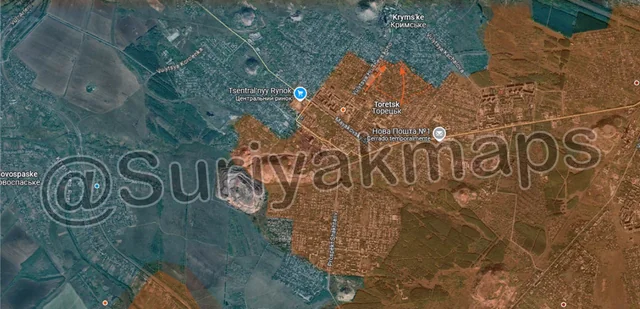
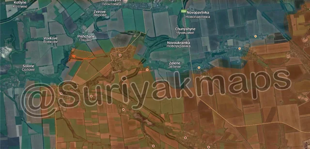
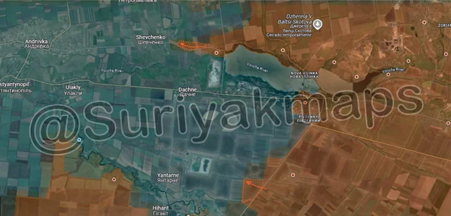
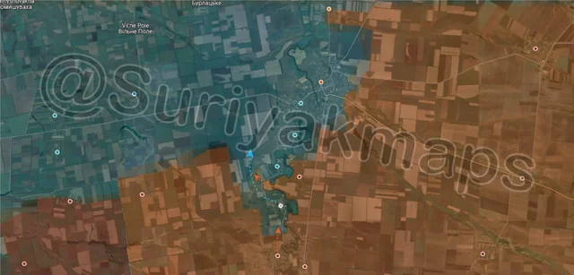
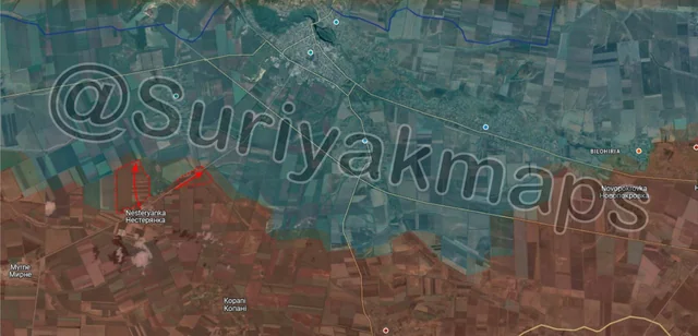
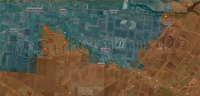
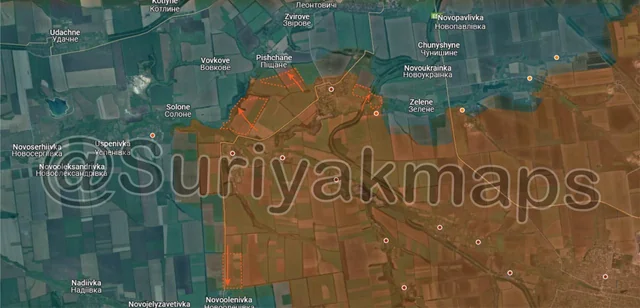
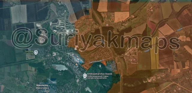
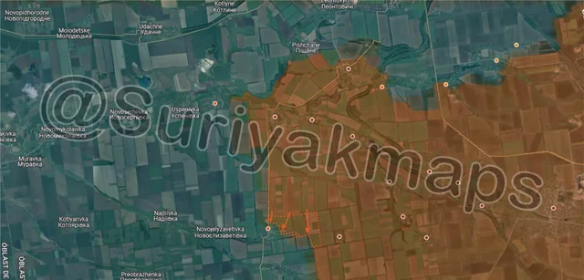
In the previous update we discussed Russia beginning to launch new attacks in Kursk (essentially stage 3 of their counteroffensive, specifically on the northern side of the front (some of which allegedly involved North Korean Troops). That continues on, with new attacks launched on Day 1027 in the northwestern area. Russian troops advanced in several directions, capturing many fields north and northeast of Novoivanovka (under the i), as well as a large section of the forested area northwest of Kruglenkoe (above the a).

Not only does this advance secure the northern flank of Novoivanovka, easing some of the pressure from the frequent Ukrainian counterattacks, but it also puts Russia within striking distance of Kruglenkoe. The village itself is quite unremarkable, being made up of 2 small streets with a few dozen residential buildings amongst the forested areas. Its importance mainly lies in its position next to said forested areas, as Ukraine has used it as a sort of staging point to reinforce northwestern Kursk, particularly months ago when Ukraine used to hold much more territory. The capture of Kruglenkoe would allow Russia to renew its attacks towards Malaya Loknya, specifically Viktorovka (previous attacks failed). Malaya Loknya is the true goal for Russia here, as the small town is the lynchpin that holds northern Kursk together. Without it, Ukraine has little hope for holding this area and will be forced back south towards Kazachya Lokyna (very bottom of map, below k) and even Sudhza (off map south).
Russian Forces Advance: 0.30 km²

Advance = 0.30km2

Heading to Toretsk, Russia has continued making progress in the town, capturing multiple streets of residential buildings on the northern side. As mentioned last update, with Russia now in control of all of central Toretsk, their progress should speed up as the remaining Ukrainian held areas are mostly smaller residential buildings which are much easier to clear/bomb.
Russian Forces Advance: 1.01 km²

Advance = 1.01km2

On the Pokrovsk front, following their successful defeat of the Ukrainian counterattacks into Shevchenko late last week, Russia has begun moving into the fields west of the town once again, capturing some treelines and part of a field next to the lake. As mentioned previously, Ukraine has begun setting up Pishchane for the inevitable battle, with Russia making positional moves before the inevitable assault of the village within the next week.
Russian Forces Advance: 1.63 km²

Top Advance = 0.42km2, Bottom Advance = 1.21km2

On the Kurakhove front, Russia resumed its push out of Stari Terny, capturing another field on their way to Shevchenko (theres a lot of Shevchenko’s in Ukraine). They’ve stopped just west of a small Ukrainian trench network on the eastern side of the village, but the main issue is the multiple larger trench networks north of Shevchenko, part of Ukraine’s Vovcha River line (some of you might remember this one from earlier this year). It will be quite difficult for Russia to push in this area, although they might be helped by a separate advance out of Sontsivka (off map north), if Russia can wrap up the battle there.

To the south, Russian forces captured a field on the opposite side of the Velyka Novosilka-Kurakhove road, as they slowly begin to venture into that area.
Context

No Advance shown

South of Velyka Novosilka, Ukrainian forces were reported to have pulled out of Makarivka (as I predicted they would last update), as Russia begin to advance from not only the south, but also by crossing the Mokri Yaly River north of the village. To be transparent, there are some conflicting reports which state that Ukraine didn’t pull all of its troops out in time, with some being encircled in and around Makarivka by that northern Russian group. We will likely see which report is true soon, but even if some Ukrainians were encircled, there would be less than 30 of them.
Russian Forces Advance: 4.09 km²

Left Advance = 3.12km2, Right Advance = 0.97km2

Moving west, on the Zaporizhia front, over the past few days a few Russian troops have made some small advances around Nesteryanka, capturing a few fields and some small trenches. This was a pretty small set of attacks, and not part of the beginning of an offensive in this area (although could be laying the groundwork for one).
Russian Forces Advance: 26.14 km²

Middle Advance = 26.14km2

Following on from Picture 1, Russia continued to press forward on that northwest side, hopping across to the next forested area along the steam and capturing most of the treelines and adjacent fields. They will likely head south from here towards Kruglenkoe, on the north side of the small lake next to the village. This will allow them to either bypass the settlement, or join up with their other push and attack Kruglenkoe from 2 sides (west and north).

The big update, and one that many people tagged/sent me messages about, was the Russian push on the east side of Kursk. This advance is a continuation of one that began late last week, although has ramped up significantly. The eastern side of the Kursk front has historically been relatively quiet (compared to the other parts at least), but has now begun to see the same level of fighting as the northern and western areas.

Over the past few days, Russian infantry began to push/continued their push across a broad front, quickly driving Ukraine back from their forward positions, capturing many fields, forested areas, and dugouts, as well as most of the villages of Russkoe Porechnoe (above the y) and Cherkasskoe Porechnoe (under the y). Ukraine did not expect this attack, and did not have nearly the same amount of equipment here as in the northern and western areas to try support their troops. Currently fighting is ongoing in Russkoe Porechnoe and Cherkasskoe Porechnoe, as Russia seeks to press the attack, and Ukraine tries to maintain their positions.
Russian Forces Advance: 1.76 km²

Left Advance = 1.32km2, Right Advance = 0.44km2

Following on from picture 3, on the west side Russian troops advanced out of Novotroitske, using the treelines as cover to push up to the outskirts of Novovasylivka. Some initial clashes are taking place in this area, as Russian DRGs try to gain a foothold in the village.

To the east, Russian assault groups in Dachenske had some success, capturing the western side of the village. The eastern half is still being held by Ukraine, although they will likely make the decision to retreat north over the Solonyi River within the next few days.
Russian Forces Advance: 1.53 km²

Advance = 1.53km2

Following on from picture 4, Russian assault groups finally captured the last of Sontsivka, after or a month of clashes with Ukraine. They’ve also crossed the Strashnyi River in a couple of places, and cleared the small forest area on the other side. With this, most of that small pocket south of the village will fall into Russian hands within the next few days, as Ukraine has little ability to contest or supply the area anymore.

Russia will also likely start heading towards Petropavlivka to assist with their advance towards Shevchenko, as mentioned in picture 4 (village is behind defence line).
Russian Forces Advance: 14.90 km²

Far Left Advance = 5.73km2, Left Advance = 3.91km2, Lower Middle Advance = 5.26km2

On the southern, and now western sides of the Kurakhove front, Russia continued to expand their control. Starting with the east, Russia captured the last of Kostiantynopolske, forcing the surviving Ukrainian troops to retreat north to Yantarne. The remainder of this area south of the Sukhi Yaly River has now fallen into the greyzone, and will almost certainly be captured by Russia over the next few days (Ukraine no longer contesting).

At the same time, further west a different set of Russian assault groups was expanding their spearhead towards Zelenivka (above the u), capturing the fields and treelines on either side. Russia is now getting much closer to the main road leading from Kurakhove out west (running through Kostyantynopil), as well as the dirt road the leads to Rozlyv (only 100m from it). This should be of serious concern to Ukraine, as Kostyantynopil is their only remaining link to the entire Kurakhove pocket and the (low) thousands of soldiers inside.
Russian Forces Advance: 9.14 km²

Top Advance = 1.09km2, Lower Left Advance = 1.73km2, Bottom Left Advance = 6.32km2

Following on from picture 5, starting with the north side, Russia captured some of the small fields northeast of Novyi Komar, as their soldiers within the village push north to capture the remainder of it. Given the river crossing north of Novyi Komar was destroyed, its unlikely Ukraine will be able to reinforce the village, and thus it will likely fall to Russia within the next couple of days.

Heading south, Russian troops, who were already advancing into Makarivka the previous day (picture 5), have captured the village, as well as the trenches and fields to the west and northwest. Conflicting reports are still being released as to whether any Ukrainian troops actually did get encircled, or if the remaining soldiers managed to retreat just in time.

A separate small Russian group also pushed one east from their positions north of Makarivka, heading towards Neskuchne (below the r). We may see a repeat of Makarivka here, as the village of Storozheve (below the u) will be cut off if Russia reaches Neskuchne. This village also has the importance of being connected to Vremivka (under the r), which sits on the west side of Velyka Novosilka and is currently their only way of supplying their garrison in the town.
Russian Forces Advance: 0.64 km²

Advance = 0.64km2

On the Oskil River front, Russia made a small advance east of Zahryzove, capturing a treeline.
Russian Forces Advance: 0.13 km²

Advance = 0.13km2

Following on from picture 2, on the opposite side of the town from their previous advance, Russia began advancing into the southernmost streets of Toretsk, capturing the first 2. Ukraine has virtually no way of reinforcing this area other than by trying to dash through the open fields west of here, and so will be unlikely to hold this area for long.
Russian Forces Advance: 3.99 km²

Top Advance = 0.62km2, Upper Left Advance = 1.64km2, Upper Right Advance = 0.70km2, Bottom Left Advance = 1.03km2

Following on from picture 8, Russian troops based in Shevchenko have made pushes around the town, capturing more fields and treelines west of the settlement, reaching the outskirts of Pishchane. They’ve also captured part of the railway line to the east, as they begin to move north along said railway towards Pokrovsk.

To the south, Russia also pushed down a treeline towards Novoolenivka, positioning themselves for an inevitable assault. The village is manned by Ukrainian troops who escaped from Pushkine (captured last week), but much like the other settlements in this area lacks any defences.
Russian Forces Advance: 0.30 km²

Advance = 0.30km2

In Kurakhove, Russian assault groups have cleared most of the remaining apartment buildings in the central section of the town, as well as the hospital complex. Ukraine now only holds a handful of apartment buildings, part of warehouses next to the reservoir, a few small residential streets, and the industrial area on the west side. The town is undeniably lost to them at this point, and proceeding to try hold much longer is only a waste of resources.
Russian Forces Advance: 0.72 km²

Advance = 0.72km2

Following on from picture 11, the same Russian group mentioned in that picture continued to advance east capturing another field and a few treelines. They are now 1.6km from Neskuchne, but probably need to widen their push before making an attempt on village, as their flank is quite vulnerable, and they will need to bring in vehicles for the assault (have to cross open ground).
Russian Forces Advance: 4.12 km²

Left Advance = 1.35km2, Right Advance = 2.77km2

Following on from picture 7, on the west side Russia has continued pushing north of the lake, occupying the treelines directly north of Kruglenkoe. There is a bridge here that Russia can cross to get into Kruglenkoe, or they will have to continue east into Nikolaevka (under the S). Its unlikely that they will be able to cut the village off, but they can surround it on multiple sides and attack Ukrainian troops trying to rotate/reinforce the area, which could force them to retreat.

Further east, the clashes in Russkoe Porechnoe and Cherkasskoe Porechnoe continue. No changes for the situation in the former, but Suriyak has made a small correction in the latter to show Ukraine still has control of the southern side of the village (so Ukrainian gain), whilst the centre section is in the greyzone as clashes make determining control difficult. Ukraine is attempting to retake their positions before Russia can consolidate their gains and dig in. Failing to do so will bring them one step closer to being forced out of Kursk.
Ukrainian Forces Advance: 0.22 km²

Left Advance = 0.19km2, Right Advance = 0.03km2

In Chasiv Yar, Ukraine regained control of the southern section of the refractary plant, bringing the front lines back to where they were last week. Some clashes continue in the area however.

To the east, Russia also made a small advance in the central suburb. This area has mostly sat in the grey zone, with infrequent changes, due to the terrain and way the battle for the town has developed. Ukraine has many bunkers, trenches and dugouts strewn throughout that southern forest, so pushing into the suburb has been difficult as Ukraine will easily counterattack it. At the same time, Ukraine isn’t interested in pushing out of their positions in the forest, as the suburb is quite exposed on all sides, and they will simply be bombed out by the Russians if they do try to push into it.

Russia may now be considering a move on the forest, but it would be extremely difficult and take them quite a bit of time. This is still uncertain, but keep it in mind.
Russian Forces Advance: 3.09 km²

Advance = 3.09km2

Following on from picture 14, Russian troops continued their advance moving south, captured several fields and treelines, as well as establishing a foothold on both the northern and eastern sides of Novoolenivka. The village will likely fall quickly, due to both its small size and lack of defences, with Ukraine almost certain to retreat west to the trench networks around Novojelyzavetivka (try say that 5 times fast).
Russian Forces Advance: 0.89 km²

Far Left Advance = 0.71km2, Lower Right Advance = 0.18km2

Following on from picture 10, after a few days of clashes around Zelenivka (below the @), capturing the village. This is the last settlement between Russia, and the final supply road leading into Kurakhove (Ulakly and Kostyantynopil don’t count as the road is in the settlement, and any fighting there would prevent its use).

Southeast, Russia also moved out of Uspenivka into the Ukrainian trench network on the western side of the road. This is the last trench network Ukraine still controls along the Sukhi Yaly River, and where most of their surviving troops from the Uspenivka pocket fled to. As Russia becomes more and more active on the northern side of this row, the pocket will begin to collapse, as the area between Yantarne and Ulakly lacks any defences.
Ukrainian Forces Advance: 2.80 km²

Left Advance = 2.80km2,