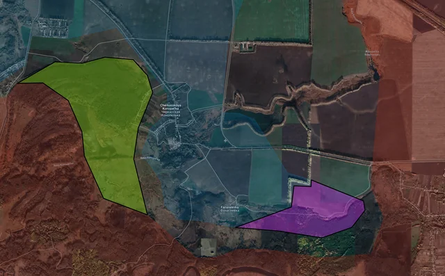
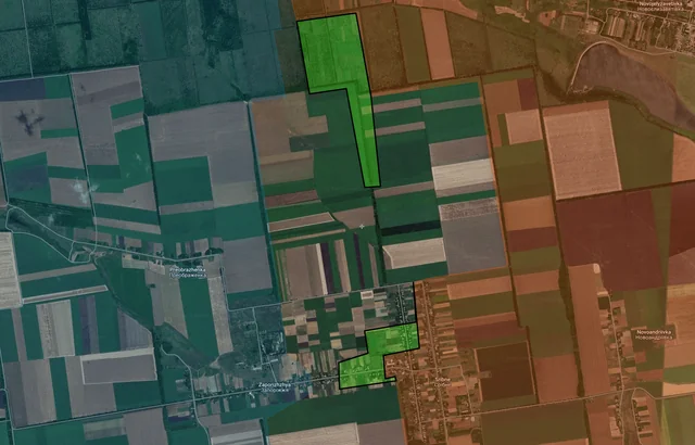
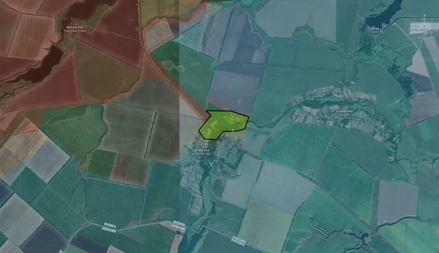
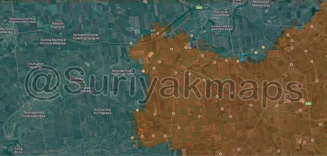
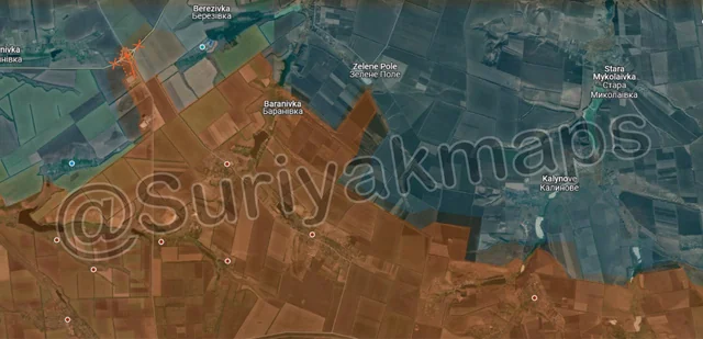
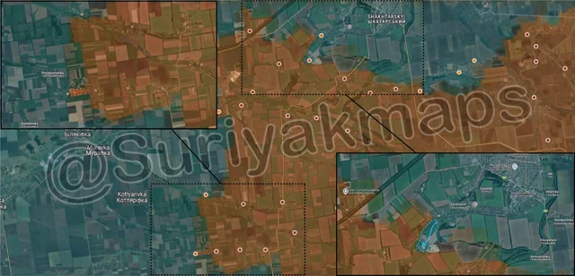
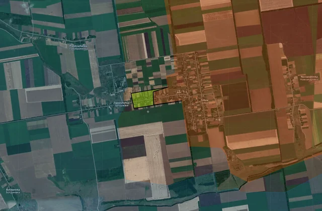
Back home
Post #157

RU POV: Russian and Ukrainian advances from Day 1081 to 1083 of the War - Suriyakmaps

Feb 8, 2025 — Feb 10, 2025 War Day 1081–1083

Suriyak decided to troll me and release the Day 1084 updates about 10 minutes before I was going to upload this post. I’m leaving those for the next post as I need the image space to show the zoomed in maps (Reddit caps posts at 20 images).

-------------------------------------------------------------------------------------------------------

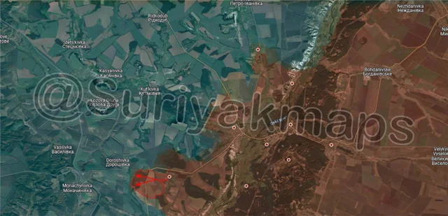
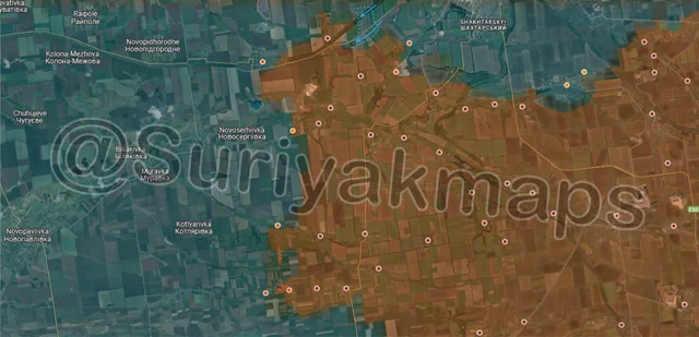
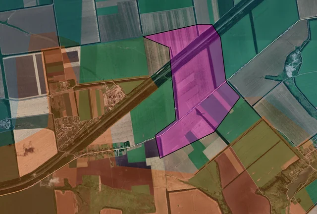
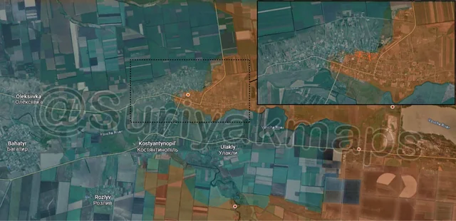
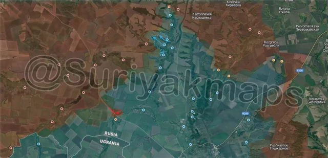
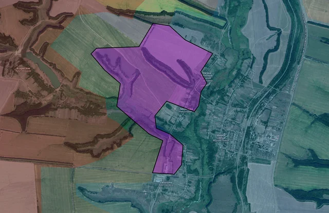
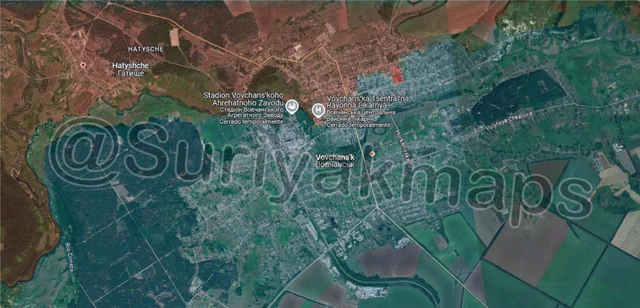
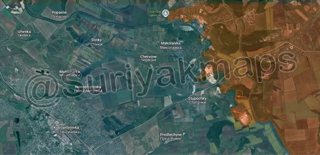
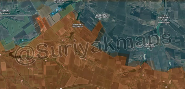
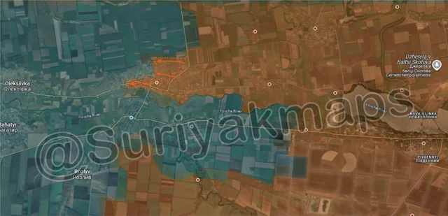
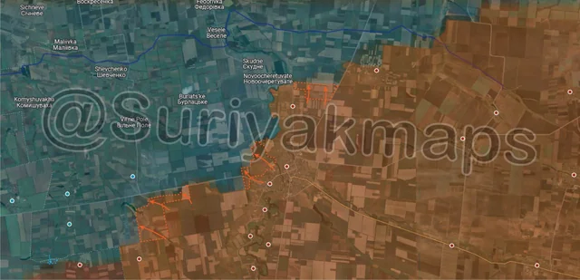
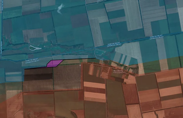
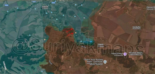
Pictures 1 to 4 are from Day 1081 (Saturday 08 February), pictures 5 to 9 are from Day 1082 (Sunday 09 February), pictures 10 to 13 are from Day 1083 (Monday 10 February).

-------------------------------------------------------------------------------------------------------

A reminder that these maps are confirming updates from previous days (i.e. 12 to 48 hours delayed from each day).

Ukrainian Advance
7.60 km²
Overall (set): 7.58 km²
Russian Advance
28.07 km²
Net Change
-20.47 km²

Situation Snapshots

Imagery, commentary, and territorial changes from the period.

20 entries
Ukrainian Forces Advance: 2.82 km²

Left Advance = 2.03km2, Right Advance = 0.79km2

Context
Kicking off in Kursk, we follow on a few days after the beginning of a new Ukrainian offensive to the south (discussed last time). Getting it out the way, we’ve had a lot more footage released from Kursk regarding the offensive attempt (on top of the enormous amount we already had), including some of the first Ukrainian filmed footage, and many more Russian drone strikes (video 1, video 2, video 3, video 4, video 5, video 6, video 7, video 8, video 9, video 10, video 11, video 12). There has been more footage released from Kursk in the past week than in the previous 2 months, owing to a significantly increased Russian Fibre-optic drone supply, and a large increase in Ukrainian activity.

As for the actual territorial changes, we have more clarification on the events that followed after the beginning of the offensive. The Russian claim of controlling the western side of Cherkasskaya Konopelka that I mentioned last time was confirmed, with some clashes taking place as the Russian infantry in the forests try to push out the Ukrainian assault groups that were dropped off in the village. To the southeast, some of the Ukrainian infantry that were dropped off in Fanaseevka have tried making their way through the forests towards Ulanok. They are being shelled and hit by Russian drones, and given the numbers and unfavourable terrain its highly unlikely they’ll be able to get to the settlement, much less secure a foothold.

Russian efforts are now focused on squeezing out Ukrainian forces from the land they took during this offensive, so we’ll have to keep an eye on this area over the next few weeks as the battle continues. Ukraine has tried to reinforce/resupply them with a few armoured cars, but given how badly the large columns did these smaller groups aren’t having much luck either. As it stands, its unlikely Ukraine can hold onto Fanaseevka or Cherkasskaya Konopelka in the medium term.

Context Advance: 3.41 km²

Advance = 3.41km2

Moving over to the Kupyansk front, Russia continues to expand its bridgehead on the west side of the Oskil River, pushing out of Zapadne with a few infantry and occupying some treelines and a few small forested areas west of the village. Judging by their movements, they are heading towards the village of Doroshivka, aiming to take it and the forest adjacent so they can prepare a staging ground for an assault on the small town of Monachynivka. The town is relatively important for this front, as it sits on the intersection of several roads in this area, meaning its loss would hamper Ukrainian rotation and supply for this part of the front.

Ukrainian Forces Advance: 3.48 km²

Top Advance = 2.63km2, Lower Advance = 0.59km2, Bottom Advance = 0.26km2

Context
On the Pokrovsk front, Ukraine continues to make counterattacks around the city, this time launching a mechanised assault towards Kotlyne and landing troops in the treelines along the road. There were some reports that stated these assault troops had actually taken the southern side of Kotlyne, whilst other sources dispute this. Either way, Ukraine is putting a lot of attention on trying to improve the tactical situation around Pokrovsk.
Context
To the south, Russian assault groups made some progress in Sribne and Zaporizhzhya, capturing more houses in the former, as well as entering the first houses of the latter. Ukraine brought in tanks to try shell them out of these buildings, however its unclear if they were successful. There was also a small advance to the north, with a few Russian infantry moving south along the treeline to link up with their forces in Sribne.
Russian Forces Advance: 0.12 km²

Advance = 0.12km2

In Andriivka, Russian assault groups made some more progress in the centre of the town, capturing a few more buildings. Ukraine’s garrison is being gradually driven out, and is struggling compared to a few weeks ago as they do not have the manpower to stop these Russian assault groups.
Russian Forces Advance: 3.55 km²

Top Advance = 2.81km2, Lower Left Advance = 0.74km2

Context
Back over to Kursk, this time on the northern side of the front. Over the past week Ukraine has improved its positions around Nikolaevka and Staraya Sorochina, retaking some of the treelines that were in the greyzone and some that were under Russian control. Theres still a lot of back and forth in this area so they will need to fight hard to maintain these gains.
Context
To the southwest, the Russian assault groups which landed in Sverdlikovo a few days prior were confirmed to have secured a foothold, taking over part of the forest area and the houses on the north side. Heavy clashes are ongoing here as both sides are determined to control the settlement due to its strategic importance (last settlement north of Ukraine’s supply lines). Lots of munitions are being used in this area by both sides.

Russian Forces Advance: 0.03 km²

Advance = 0.03km2

Over in Vovchansk, some Russian infantry were spotted moving through the ruins on the eastern side of the town, entering (what remains of) the school. As with the previous update here, consider this proof of Russian presence in this area, rather than a proper advance.

Russian Forces Advance: 1.12 km²

Advance = 1.12km2

South of Chasiv Yar, Russia attacked the Pivdenno-Skhidnyi Mine and surrounding forest area once again, taking them over. This makes it the sixth time this location has traded hands in the last 6 months, and I won’t rule out Ukraine counterattacking once again to try capture it.

The main problem here for both sides is that there is a lot of cover in the area around the trench networks and dugouts, meaning its quite easy for enemy troops to push up under the trees and attack the positions around the mine. To properly secure the mine, they would have to push the front line even further away and capture either the canal bank (for Ukraine) or the forest to the west (for Russia).

On a related note, Russia has started setting up drone netting over the roads between Bakhmut and Chasiv Yar, in order to protect the supply and equipment being sent to the soldiers participating in the battle for the town. I can’t comment on the effectiveness, but I’d say it’s a decent idea to help reduce losses given how much they use that road.
Russian Forces Advance: 2.24 km²

Top Left Advance = 0.81km2, Top Right Advance = 1.43km2

On the far eastern side of the Pokrovsk front, Ukraine counterattacked into Vodyane Druhe, driving out the Russian assault group that had captured the small village a couple of days prior. At the same time, a different Russian assault group moved up along the main road, capturing the livestock farm near the highway interchange.
Russian Forces Advance: 3.50 km²

Top Right Advance = 1.02km2, Bottom Advance = 2.48km2

Back to the Pokrovsk front, this time in the central area. Ukraine launched another counterattack, sending a mechanised group from the city, past Lysivka into eastern Dachenske. A few Ukrainian assault groups are entrenched on the eastern side, with Russia currently trying to drive them out with drones and artillery.

To the southwest, following on from picture 3, Russia made more progress in Sribne, capturing the remaining buildings as well as the fields to the north, confirming full control of the settlement. Fighting is continuing however, as Russia is still assaulting adjacent Zaporizhzhya.
Russian Forces Advance: 0.28 km²

Advance = 0.28km2

Following on from picture 8, the Russian group that took the livestock farm the previous day advanced up to the highway interchange, taking control of it. Whilst this may seem important, in reality this advance changes little, as Ukraine had stopped using this highway for supply long ago due to Russian drones being too close, and Ukraine blew up the interchange a few weeks ago, meaning it can’t be used by Russia.

If anything, this advance just opens the way for further attacks towards Malynivka (off map top left), although Russia will need to take Yelyzavetivka (blue dot above @) first.
Ukrainian Forces Advance: 1.30 km²

Top Advance = 1.17km2, Bottom Advance = 0.13km2

Following on from picture 9, Ukraine continued its counterattack into Pishchane, using another mechanised assault to land troops in the northern side of the village. Heavy clashes are ongoing as the assault groups try to take over the settlement. Sources for both sides have made a variety of claims, from Ukrainian sources stating the entire village is already under their control, to Russian sources saying the assault groups were driven out. For now, we know the assault groups made it to the settlement, and are being shelled and bombed, but the actual control of the various buildings is unknown.
Context
Further south, Russia made more progress in Zaporizhzhya, taking over part of the centre of the village. About half the settlement is under Russian control, with the other half under attack right now.

Russian Forces Advance: 2.36 km²

Top Advance = 1.77km2, Lower Left Advance = 0.59km2

Following on from picture 4, Russian assault groups continued to press the attack in Andriivka, taking over most of the northern side of the town, as well as advancing deeper into the western suburb. At this point its safe to say the settlement is lost, with Ukraine only holding onto a handful of houses and the trench network on the northwestern side.

Once Andriiva is completely captured, Russia will likely continue pushing west, but may attempt a crossing into northern Kostyantynopil if they believe there is an opening.
Russian Forces Advance: 14.87 km²

Top Advance = 2.61km2, Middle Advance = 5.91km2, Bottom Left Advance = 6.26km2, Far Bottom Left Advance = 0.09km2

On the Velyka Novosilka front, after 2 weeks of rest and regrouping, Russian forces have started to become active once again. To the north, they cleared and captured several fields next to Novyi Komar, as the begin their move towards Dniproenerhiya (above Skudne). Next to Velyka Novosilka itself, a separate Russian group began to move into the fields northwest of the town, taking over a few treelines and fields as they head towards either Burlatske or Novoocheretuvate.

Further west, yet another Russian group began to push towards the western road, capturing a number of fields and treelines as they head towards Novosilka (blue dot below S).
Context
Additionally, there was a minor correction to the frontline west of Novodarivka, with Ukraine controlling a bit more of a treeline than previously reported (was greyzone). No offensive movements from Ukraine in this area at this point.