Back home
Post #285

RU POV: Russian and Ukrainian advances from Day 1620 to 1626 of the War - Suriyakmaps

Aug 1, 2026 — Aug 7, 2026 War Day 1620–1626

Pictures 1 to 14 are from Day 1620 to 1626 (Saturday 01 August to Friday 07 August).

------------------------------------------------------------------------------------------------------

Live map can be found here, Suriyak’s twitter can be found here.

Ukrainian Advance
20.47 km²
Overall (set): 20.47 km²
Russian Advance
252.96 km²
Net Change
-232.49 km²

Situation Snapshots

Imagery, commentary, and territorial changes from the period.

20 entries
Russian Forces Advance: 1.96 km²

Advance = 1.96km2

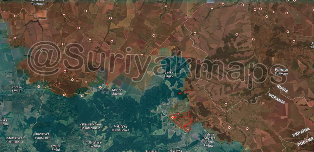
Kicking off in the Sumy border area, Russia slightly expanded its control near Sopych, taking over parts of a few treelines. To the south Russia has also continued pressuring Ulanove but no progress has been confirmed yet.
Russian Forces Advance: 5.49 km²

Advance = 5.49km2

Onto the main part of the Sumy front, on the south side, Russian attacks towards Mohrytsya that started a couple of weeks ago have moved into the village itself, with clashes ongoing (control is debateable).
Russian Forces Advance: 18.38 km²

Middle Advance = 15.70km2, Lower Left Advance = 1.68km2, Bottom Right Advance = 1.00km2

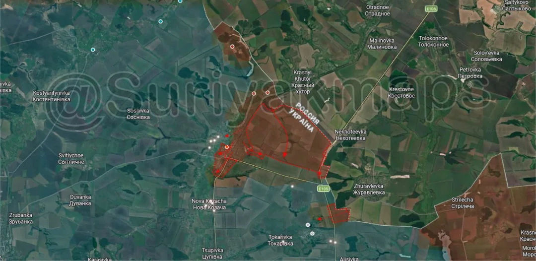
Over in the Kharkiv border area, over the past few weeks Russia took control of the treelines and fields along the border northeast of Kozacha Lopan, all of which were unoccupied due to being too exposed and inaccessible once Russia entered the town.

Within Kozacha Lopan Russian forces expanded their control of the eastern half of the town, taking control down to the southern edge (still one street left), whilst other groups have begun trying to move into the west side of the locality on the other side of the Lopan River.

To the southeast the Russian troops that crossed the border and took over the small cluster of houses last week have moved onto the highway and are now attacking Kudiivka.
Russian Forces Advance: 82.69 km²

Lower Middle Advance = 36.98km2, Bottom Left Advance = 43.14km2, Bottom Right Advance = 2.57km2

Context
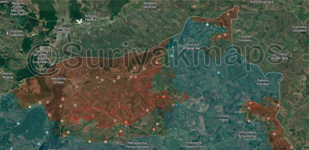
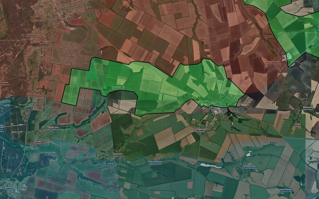
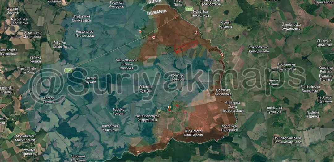
Heading to the northern front, the larger Russian pushes have continued for yet another week, leading to a lot of territory changing hands. Starting on the southwest side, Russian DRGs continue to push out deeper south into Ukrainian lines, moving into Losivka, Shesterivka, Ukrainske, Shevchenkove and Yurchenkove. As for proper advances Suriyak has marked a large portion of the fields and treelines here, including Zemlyanyi Yar (Russia claims to have taken it last month) and about half of Bilyi Kolodyaz. With the latter it is true Russia is present within the town (several geolocations) however I am not sure I would define it as control just yet.
Context
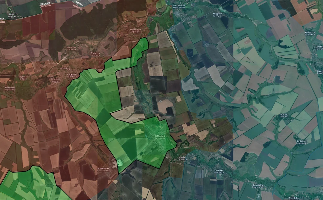
To the northeast, Russia looks to have taken control of Zakharivka, which they entered a little over a week ago, as well as some of the fields northwest of the village. Fighting is now ongoing over neighbouring Ivanvivka, whilst other Russian DRGs are continuing to push east to try and collapse the pocket.
Context
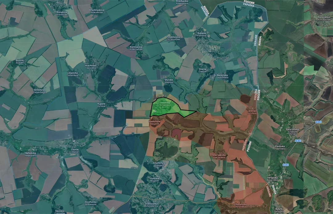
Speaking of, out east the Russian assault groups that took Ivashchyne last week have now captured neighbouring Ustynivka. They are now fanning out into the surrounding area, looking to take over Anyshchyne, Bereznyky, Shyroke and Kupyne before Ukraine can respond.

With regards to the pocket, the distance between the Russian controlled positions on either side of the mouth is now sitting at 18.5km, whilst the gap between Ukrainian held positions on either side (i.e.no greyzone) is about 15.8km. This gap is made up of 6 villages, although Russia would only realistically need to capture the outer ones on each side and contest the next ones in to cut the Ukrainians off (due to poor road connectivity).
Russian Forces Advance: 4.81 km²

Advance = 4.81km2

Down to the Lyman front, heavy clashes continue inside and north of the town, with no confirmable changes in control. Southeast of this Russia looks to have regained control of Yampil once again after clearing the Ukrainian infiltrators out and is now pushing to try assault Ozerne once more.
Russian Forces Advance: 8.86 km²

Lower Middle Advance = 1.98km2, Lower Left Advance = 2.71km2, Upper Bottom Left Advance = 1.54km2, Lower Bottom Left Advance = 2.63km2

Context
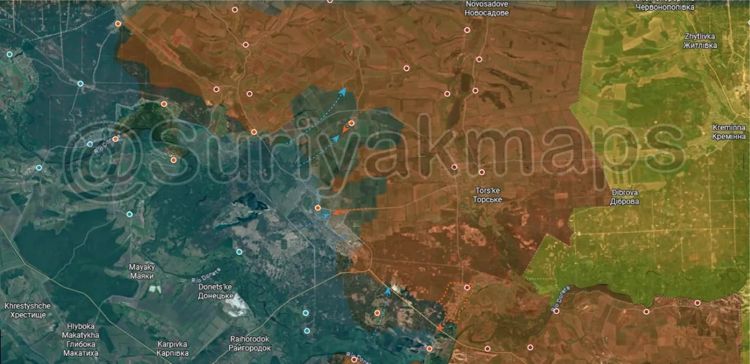
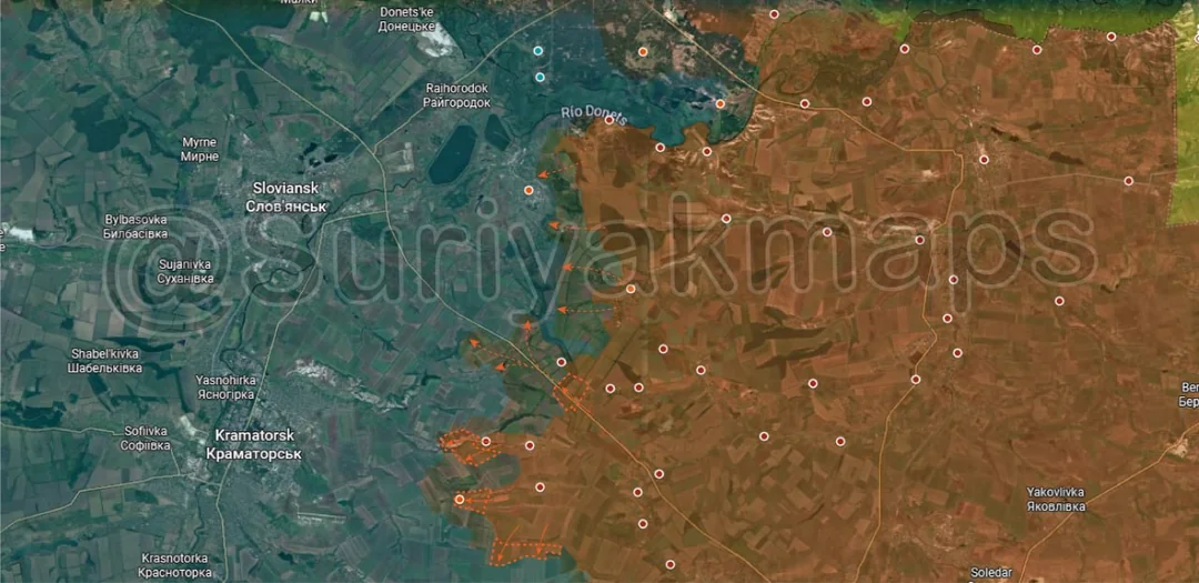
Moving to the Slovyansk front, starting on the north side, Russia continues to send DRGs into and around Mykolaivka, looking to capture more of the region east of the canal and enter the town.

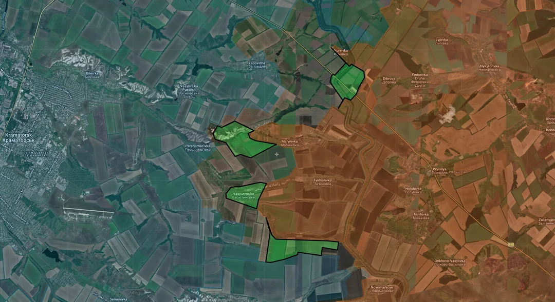
To the south, Russia captured the remaining section of the canal near Yurkivka, including the road crossing, with other DRGs moving into the nearby village of Zapovidne.

Southwest, Russian assault groups stepped up their operations from Malynivka and Tykhonivka, capturing more of the ridge and fortifications near Pershomarivka, as well as securing most of Vasyutynske and some nearby treelines.

We are starting to reach the point where Russia will control all of the villages east of Kramatorsk city, meaning any following push will put them close to entering the locality. Still, there are a significant number of fortifications in layers around the city, so I believe any proper Russian entry into Kramatorsk is a ways off.
Russian Forces Advance: 15.40 km²

Middle Advance = 2.33km2, Lower Left Advance = 12.61km2, Lower Middle Advance = 0.46km2

Down to the Kostyantynivka front, on the north side the first Russian group has entered Fedorivka following their recent capture of Markove, as heavy shelling continues in the surrounding area.

To the south, Russia has recaptured part of the railway and nearby treelines west of Chasiv Yar, as their troops try to make their way back into Virolyubivka.

Immediately southeast of this, Russia secured more of the village of Mykolaivka as they clear out the remnants of the Ukrainian garrison, as the small pocket continues to shrink.

West of this, Russia looks to have finally secured Molocharka (greyzone for a while now) and the nearby fortifications, moving north towards the village of Stinky and the railway. If they are successful they will encircle whatever is left of the Ukrainian force that held the villages and outskirts of Chasiv Yar, though I doubt that will be more than 30 soldiers at this point.
Russian Forces Advance: 15.82 km²

Middle Advance = 14.38km2, Bottom Left Advance = 1.44km2

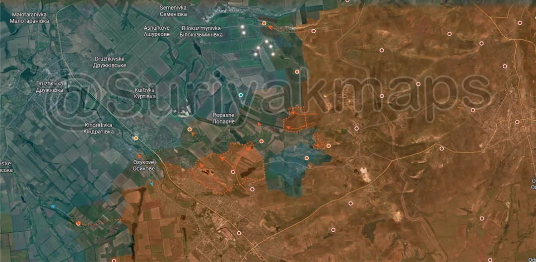
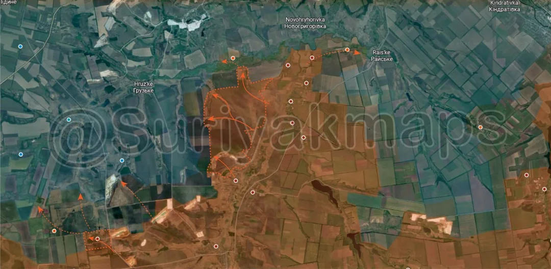
Out west on the other side of the Kostyantynivka and Dobropillya fronts, Russia has continued to push out into the villages along the Kazenyi Torets River after their capture of a few last week, moving into Petrivka (west of Raiske). Things are getting interesting here as there has been a lack of Ukrainian response and further Russian gains here will destabilise Ukraine’s hold on the large area of fields to the southeast and also threaten the west side of Druzhkivka.

West of this, other Russian groups moved out into the fields west of the river and have reached the minor village of Novomykolaivka, which sits on the other side of the Hruzka River.

Southwest, clashes have begun over the area between the quarries, Kucheriv Yar and Vilne, as Russia tries to enter the latter two once again.
Russian Forces Advance: 25.28 km²

Upper Advance = 12.52km2, Lower Advance = 5.80km2, Bottom Left Advance = 6.96km2

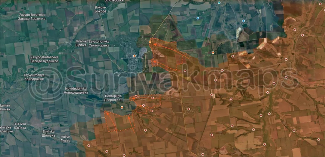
Moving to the main part of the Dobropillya front, on the north side Suriyak has marked the greyzone outside the city as well as the eastern section of Hannivka as under Russian control following their pushes into this area over the past couple of weeks. I do agree that Russia is in this area but I disagree with them having control as there are few troops and a lot of open ground to cover. Assuming this is the case Russia may end up securing chunks of eastern Dobropillya and Hannivka first despite that being the more difficult side to attack due to the fortifications and lack of cover.

To the south, Russia secured Chernihivka, Vodyanske and Krasnopodillya after Ukraine was seemingly forced out over the past few weeks, although some soldiers likely remain hidden in basements and the outer fortifications. Next to this other Russian troops have advanced and are trying to move into Matyasheve and the village of Dobropillya, after which they can push on and enter the city of the same name.
Russian Forces Advance: 5.85 km²

Upper Left Advance = 1.88km2, Middle Left Advance = 3.97km2

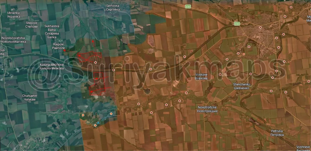
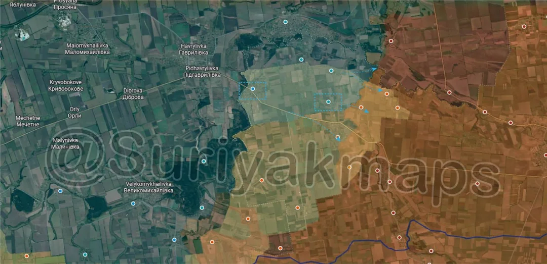
Heading to the west side of the Pokrovsk front, Russia has spent the last few weeks trying to expand the buffer around Novopidhorodne, capturing some nearby treelines and attempting to enter the village of Raipole. Both sides still have minimal forces here so all movements are going to be slow and attacks infrequent.
Ukrainian Forces Advance: 20.47 km²

Advance = 20.47km2

Context
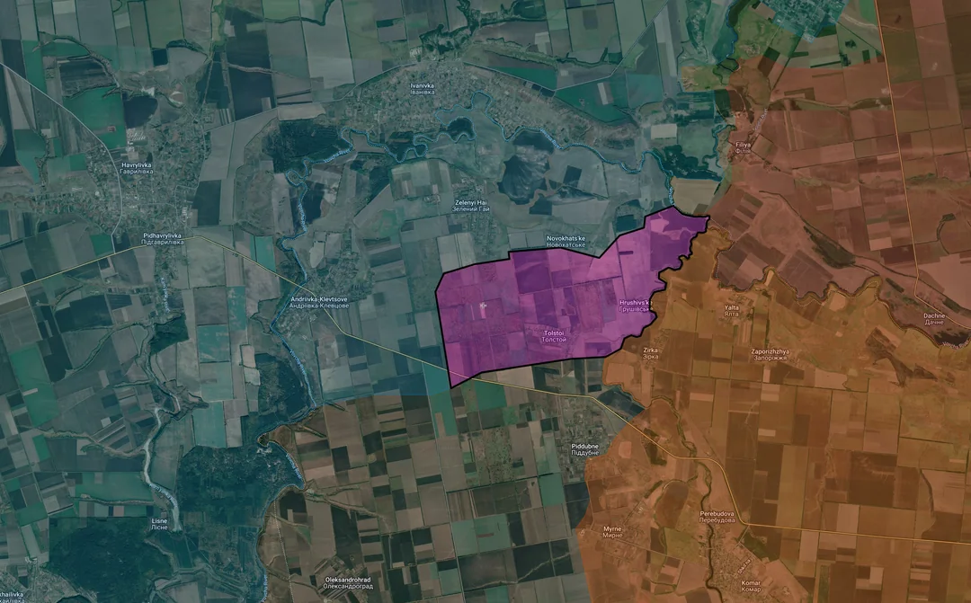
Over to the Komar front, Ukraine has continued its infiltrations and assaults on the villages near the Mokri Yaly River, finally capturing Tolstoi and Hrushivske (have been in greyzone for well over a month) and moving deeper into Piddubne and Myrne. The other villages in this area are starting to fall to Ukraine as their assaults continue, pouring more troops south in their attempt to reach Komar.
Russian Forces Advance: 11.41 km²

Advance = 11.41km2

Onto the Hulyaipole front, on the northwest side Russian DRGs continue to operate well behind Ukrainian lines, reaching Zirnytsya and Lyubytske. As I’ve said many times before they do not control these villages they claim to capture but it is true that they have been able to get soldiers here consistently, highlighting how porous the frontline is.

To the south Russia captured some more treelines west of Hirke and are increasing pressure on Kopani, Dolynka and Rivne.
Russian Forces Advance: 20.54 km²

Middle Advance = 16.19km2, Right Advance = 4.35km2

Context
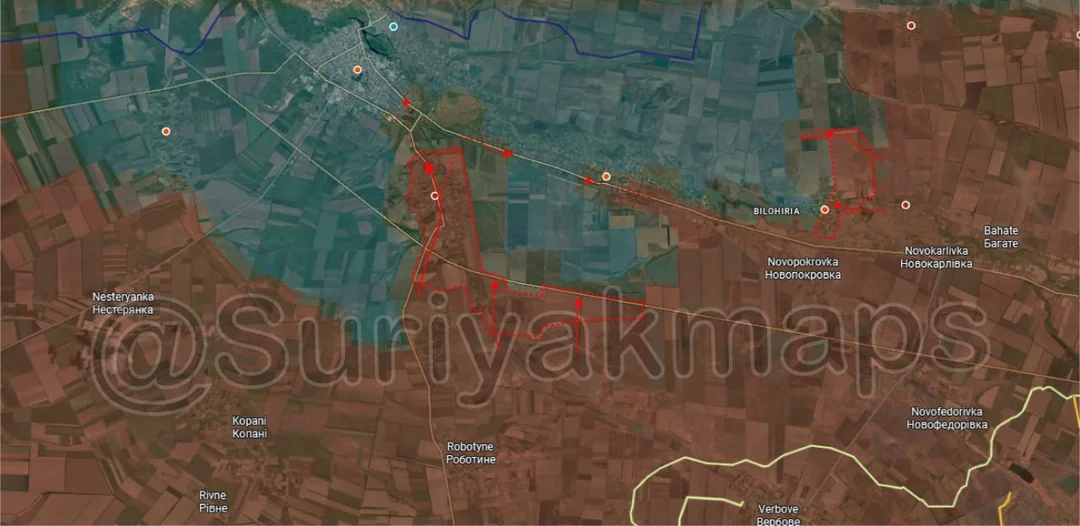
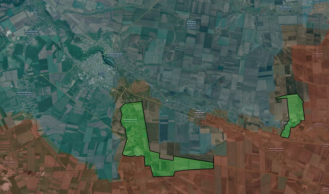
Out on the Orikhiv front, there have been some interesting developments building over the past few weeks. Starting with the more mundane on the east side, Russian forces recaptured half of Bilohirya and some nearby treelines after a period of skirmishes following a Ukrainian push in mid July. The village has practically been levelled after years on the frontline so it provides minimal benefit to either side, hence why there hasn’t been any concerted effort by Russia or Ukraine to take and hold it.

To the west, recent geolocations and reports have shown an increase in Russian activity from in and around Novodanylivka and Mala Tokmachka. Several Russian DRGs have reached the eastern edge of Orikhiv and even western Mala Tokmachka (the rear), which would indicate the Novodanylivka is now either in the greyzone or under Russian control. This is the first time the Russians have entered Orikhiv and have reached western Mala Tokmachka, which is naturally quite a big deal and comes as a surprise as almost no progress has been made by Russia attempting to reach Orikhiv head on for years. I have even seen some sources suggest that Mala Tokmachka has mostly fallen, but I would be wary about marking any changes in the town and even Novodanylivka for now as there is a lack of information.

Something has clearly occurred on this front but I have had significant difficulty in determining exactly what. A lot of sources have been incredibly quiet (hence why it seems to have happened so suddenly) whilst others are giving vague accounts of who controls what. I don’t think Russia has as much control as depicted here but they are likely trying to take advantage of whatever weakness has appeared to break into Orikhiv and start the battle well ahead of when they expected to.
Russian Forces Advance: 36.47 km²

Advance = 36.47km2

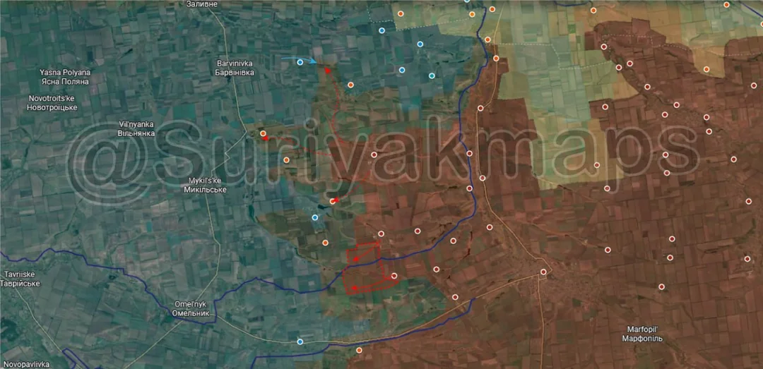
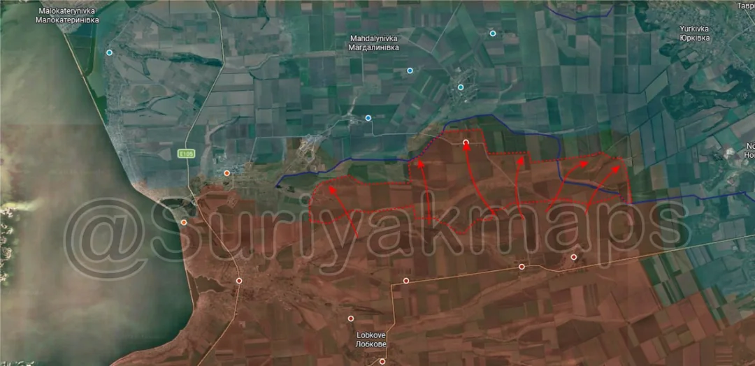
Ending on the Zaporizhia front, Russian assault groups continued their wide push to regain lost ground and capture more treelines, moving forward across a 15km stretch and reaching the village of Pavlivka. Suriyak shows this as being entirely recaptured by Russia however I’d put it in the greyzone as fighting does look to be continuing either in the locality or nearby.

The eastern third of this advance is the most interesting aspect, as this puts Russia further north than they have been before (so captured not recaptured) and over the first layer of Ukraine’s Zaporizhia fortification line. Whilst certainly not the first time they have crossed it this particular section is important as those thicker treelines you see on the far right side (above the s) lead up to a forest area and the rear of Novopavlivka. One of the supply routes for Orikhiv runs through this village, so if Russia can get DRGs along these treelines into that forest or Novopavlivka it will halt supplies travelling via that route, all at a time when Orikhiv is suddenly under pressure from the front.

Ironically if this did occur it would be a exact inverse of what I predicted in late 2025 would happen with Orikhiv….