Back home
Post #289

UA POV: Russian and Ukrainian advances from Day 1648 to 1654 of the War - Suriyakmaps

Aug 29, 2026 — Sep 4, 2026 War Day 1648–1654

Pictures 1 to 21 are from Day 1648 to 1654 (Saturday 29 August to Friday 04 September).

------------------------------------------------------------------------------------------------------

Live map can be found here, Suriyak’s twitter can be found here.

Ukrainian Advance
272.41 km²
Overall (set): 269.13 km²
Russian Advance
152.54 km²
Net Change
119.87 km²

Situation Snapshots

Imagery, commentary, and territorial changes from the period.

21 entries
Context

No Advance

Kicking off on the Sumy border area as standard, over the past couple of weeks Russia has continued their attacks against Ulanove, expanding the greyzone in and around the village but has so far been unable to consolidate.
Russian Forces Advance: 37.13 km²

Advance = 37.13km2

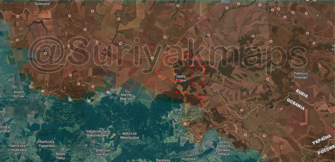
Over on the main Sumy front, on the east side Russian infantry groups took control over Sadky farms and much of the surrounding forest areas over a month of infiltration and attacks. They are currently trying to push deeper into the main forest area to reach Mohrytsya and link up the two areas of attack (forest will provide continuous cover from over the international border).

Over the same time period to the west Ukraine counterattacked towards Nova Sich and Ivolzhanske, where clashes are taking place.
Context Advance: 1.32 km²

Advance = 1.32km2

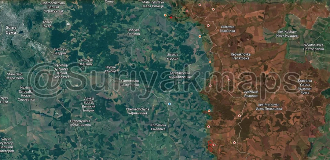
Down south on the other part of the Sumy border area, Russia recaptured the last houses in Ryasne after sporadic fighting on the outskirts over the past couple of months.

There was also a Russian push seen further north towards Velykyi Prykil but with minimal information there is not much to comment on.
Russian Forces Advance: 7.31 km²

Left Advance = 4.76km2, Middle Left Advance = 2.55km2

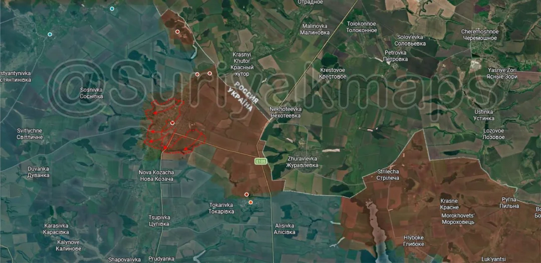
Moving to the Kharkiv border area, after another couple of weeks of clashes Russian assault groups have taken control of the town of Kozacha Lopan. As always they will need to work on establishing a buffer around the locality, but once that is done the question becomes whether Russia continues to push deeper into Kharkiv and turns this into a proper front (similar to the area near Lyptsi and Vovchansk) or do they stay within 7 or 8km of the border where they have ample support and safe positions?
Context

No Advance

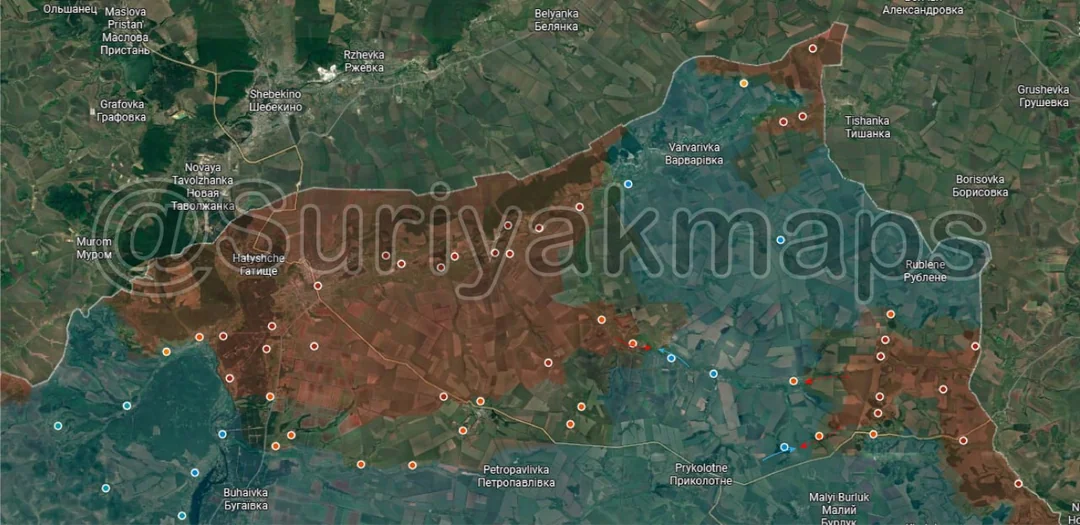
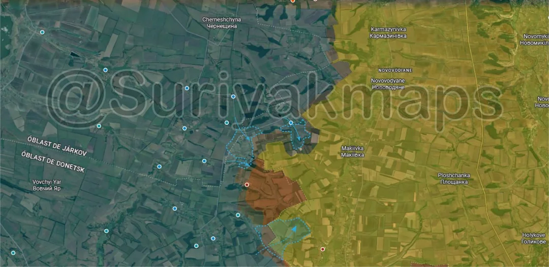
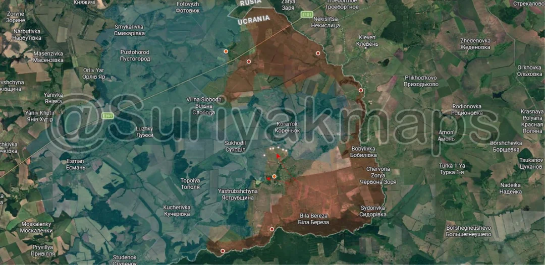
Heading to the northern front, clashes continue on either side of the pocket in the edge of Kharkiv Oblast, with Ukraine counterattacking in their attempts to push Russia back and avoid encirclement.
Context

No Advance

Down to the northern side of the Kupyansk front, Ukrainian assault groups have continued their attacks for another week, targeting the western houses of Dvorichna and the forests behind Zapadne. As I mentioned last week, these attacks have been going on for months now, although progress and footage has only recently been released showing progress.
Russian Forces Advance: 0.22 km²

Advance = 0.22km2

Down once again, this time in western Kupyansk where Russia has slowly been expanding its control of the town, recapturing some more streets on the southwest side of the locality. Unlike last year this part of the battle for Kupyansk (as the fighting here hasn’t stopped in over a year) is proceeding much more slowly and methodically, with fewer soldiers involved from both sides.
Ukrainian Forces Advance: 6.33 km²

Upper Right Advance = 0.84km2, Bottom Right Advance = 5.49km2

Onto the Oskil River front, on the north side Russia has once again started to move through the southern parts of Zahryzove and re-entered Bohuslavka.

To the south, Ukraine recaptured several treelines east of Borova and has pushed Russia back to their positions from August.
Ukrainian Forces Advance: 14.23 km²

Middle Left Advance = 3.85km2, Middle Advance = 3.40km2, Bottom Advance = 6.98km2

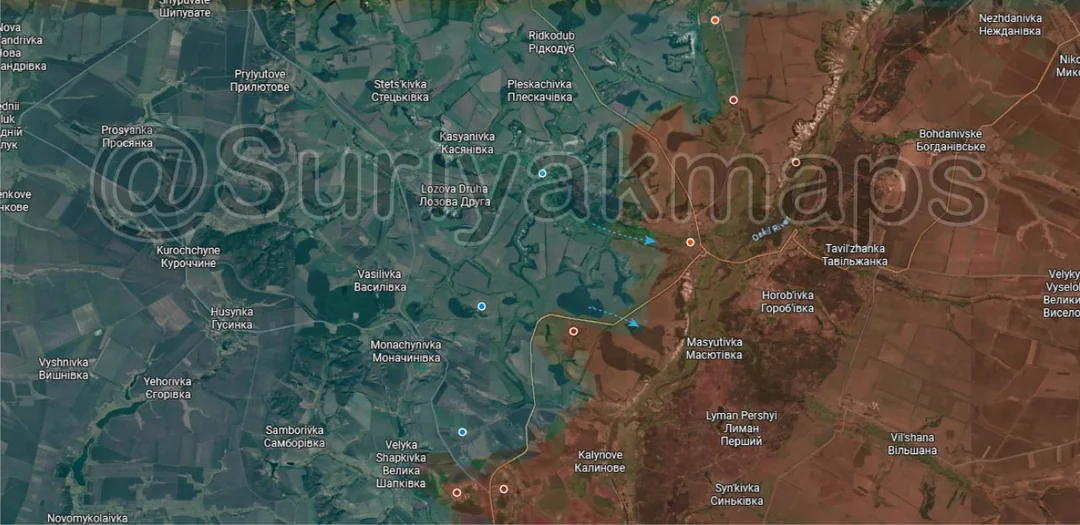
Heading down to the northern side of the Lyman front, due to the deteriorating Russian position west of the Nitrius River Ukraine also stepped up its assaults on the area northeast of Nove, retaking Hrekivka (was mostly greyzone) and treelines in several areas.
Ukrainian Forces Advance: 175.09 km²

Middle Advance = 158.52km2, Middle Right Advance = 8.26km2, Lower Right Advance = 1.07km2, Bottom Advance = 5.10km2, Very Bottom Advance = 2.14km2

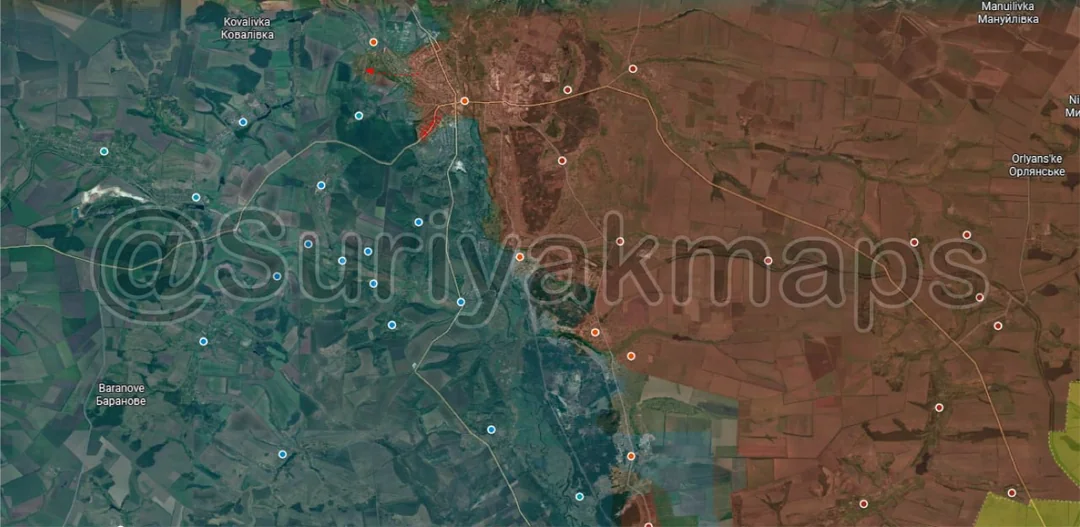
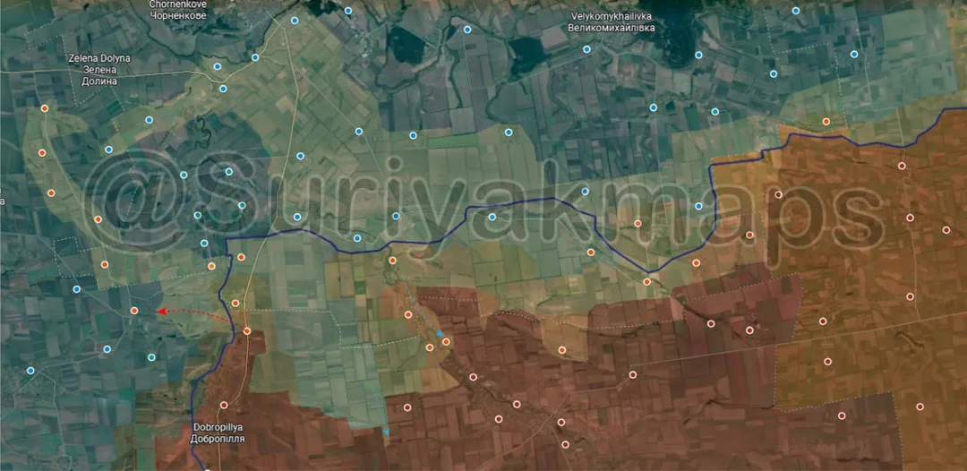
Moving south to the main part of the Lyman front, following on from their earlier success during the months of their counteroffensive, Ukraine continued to press the attack on all sides of the front. Russian forces reportedly initiated a withdrawal from the entire salient several weeks ago, leading to the abandoning of most positions west of the Zherebets River, bar the villages along its western bank. This has led to Ukraine recapturing Serednje, Shandryholove, Novoselivka, Derylove, Drobysheve and Zelena Dolyna, whilst also retaking most of the greyzone in Lyman.

As I mentioned last week, information on all this is incredibly sparse and I don’t have much to go off of, so I can’t provide much more detail than what is being reported/claimed. This undoes much of this Russian grouping’s progress throughout 2025 (the frontline barely moved in Lyman in 2026 with many months of attacks and counterattacks), but Russia will be looking to maintain their bridgehead west of the Zherebets River and near Lyman so they can regroup and start pushing back in the future.
Russian Forces Advance: 6.35 km²

Lower Left Advance = 2.83km2, Bottom Left Advance = 2.18km2, Far Bottom Left Advance = 1.35km2

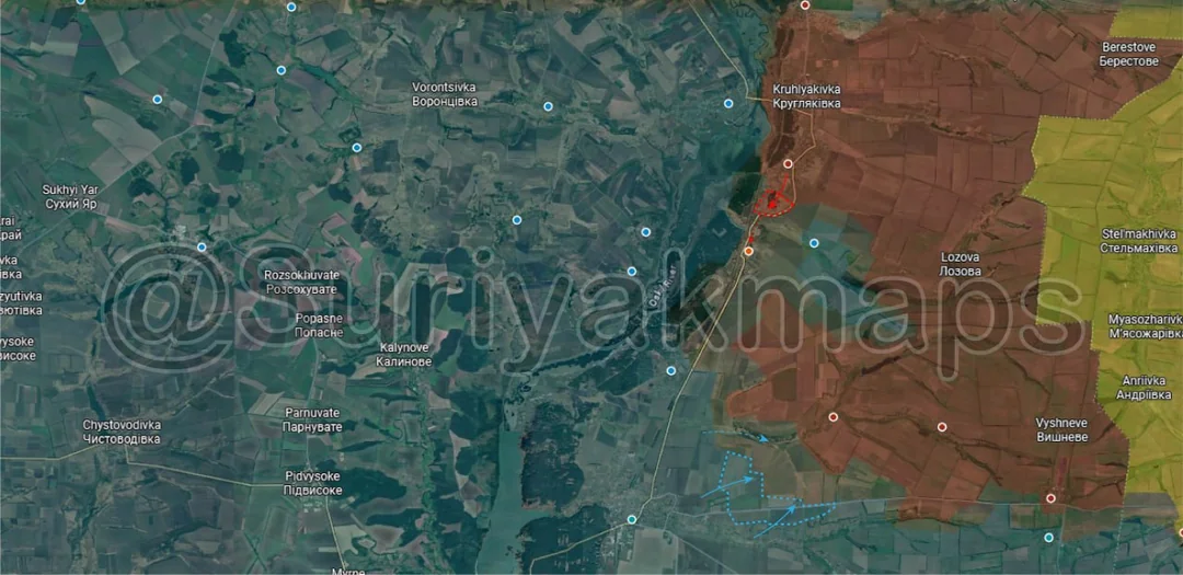
Over on the Slovyansk front, Russian assault groups have captured more of the treelines on either side of Yurkivka, whilst also moving into the village of Zapovidne. This is one of the last localities Ukraine still holds east of the fortress cities, so will not be easy for Russia to gain control over.
Russian Forces Advance: 16.00 km²

Middle Left Advance = 5.37km2, Middle Right Advance = 3.79km2, Right Advance = 1.04km2, Bottom Left Advance = 1.64km2, Bottom Right Advance = 4.16km2

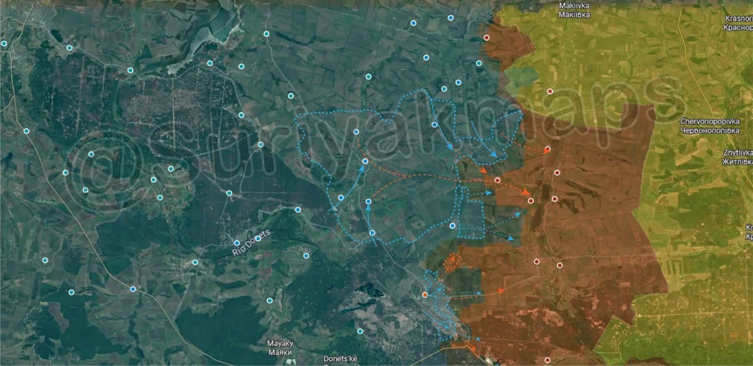
Onto the Kostyantynivka front, over the week Russian forces have stepped up their attacks on the pocket east of the city, which has collapsed after months of pressure. Whatever Ukrainian force that was still present there after Kostyantynivka fell has effectively been wiped out, with the Russians now clearing out the last buildings in Chervone and Podilske, as well as capturing more of the treelines north and south of those villages.

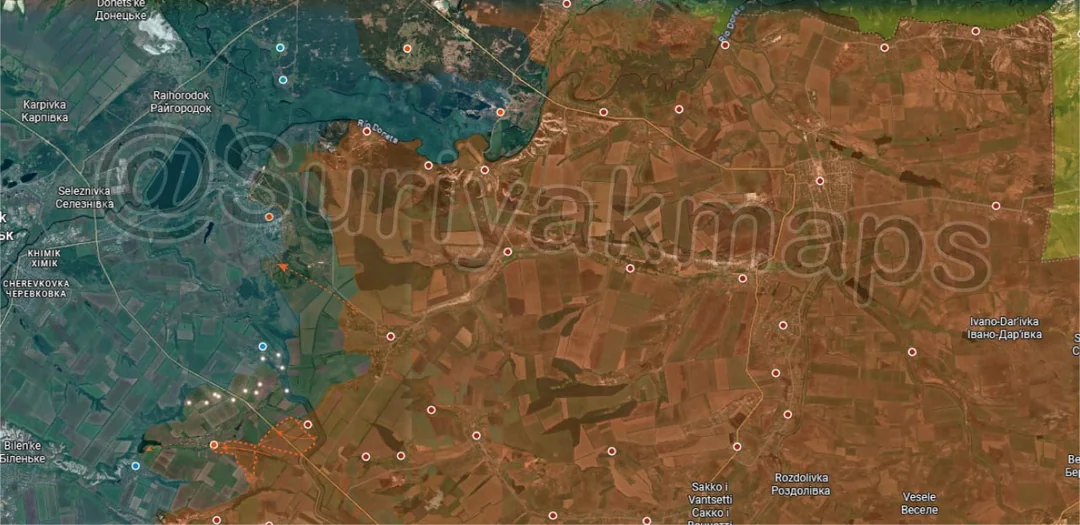
A little west of this, other Russian troops have been pushing along the railway and attacking Virolyubivka and Popasne, whilst separate groups moved up from the south and are now in control of half of STINKY.

Yes, this is a real village, and I’ve been waiting years to mention it in one of these posts.

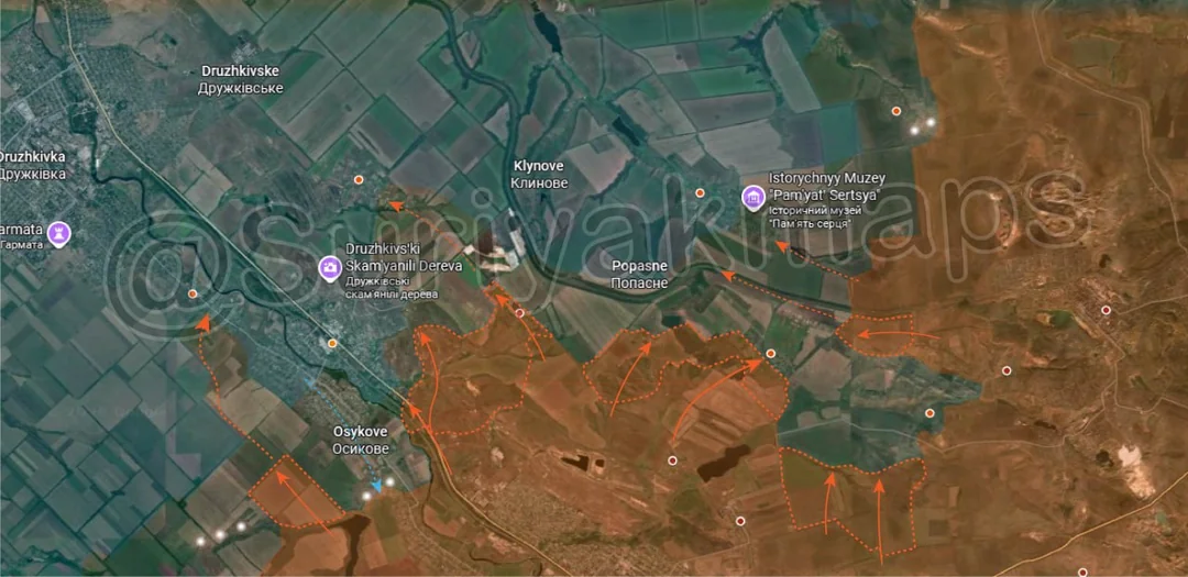
West again, other Russian groups have moved slightly uphill from Oleksijevo-Druzhkivka, taking over the nearby treelines and the village of Izhevka. At least one DRG has then gone on to enter Kurtkivka, where pressure is now mounting.

On the opposite side of the Kryvyi Torets River Russia has also captured some treelines south of Osykove, with more DRGs moving around the small town towards Kindrativka. Combined with the above, Russia is trying to outflank both Osykove and Oleksijevo-Druzhkivka due to the high concentration of Ukrainian troops holding the localities (sent there post fall of Kostyantynivka). At the same time Ukraine is still trying to send troops back into Kostyantynivka to try open up the battle again, but without success.
Russian Forces Advance: 31.38 km²

Left Advance = 20.66km2, Upper Middle Advance = 0.96km2, Lower Middle Advance = 2.61km2, Lower Right Advance = 1.50km2, Bottom Right Advance = 5.65km2

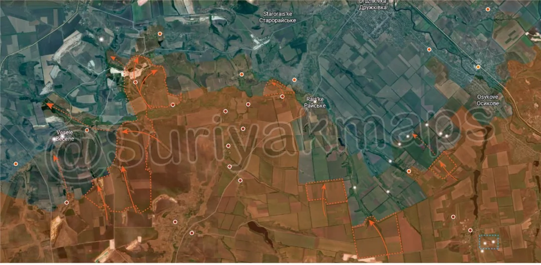
Moving west on the Kostyantynivka and Dobropillya fronts, Russia has been working on clearing the treelines in the pocket north of the quarries, capturing a few in several different areas.

To the northwest, at least one Russian group crossed the Kazenyi Torets River from Petrivka and has entered Raiske, taking over one of the outer streets. Combined with earlier crossings further west of here Russia is starting to build its bridgehead over this river, from where they can strike towards the rear of Druzhkivka.

To the west, Russian troops continued their attacks from Novomykolaivka and have managed to push up to and through the mine area of Novoandriivka, reaching the main part of the village. Simultaneously other groups on the south side of the Kazenyi Torets River have been pushing through the treelines north of the quarries and are now attacking Hruzke, Vesele and Zolotyi Kolodyaz. The capture of these would open the way for a continued Russian push north to begin encircling Druzhkivka, so it is imperative that Ukraine holds their fortification lines here.

I’ll also add that some DRGs have been spotted even further back then shown here, past Hruzke and all the way to Novotroitske (off map top left), however these are isolated incidents for now.
Russian Forces Advance: 3.87 km²

Advance = 3.87km2

Onto the Dobropillya front, slightly west of the previous picture, Russian soldiers have captured the village of Rubizhne. Attacks are now being launched on Zolotyi Kolodyaz from the southwest and southeast, and with minimal Ukrainian response so far its unclear how long the locality will hold once Russian troops begin to enter it.

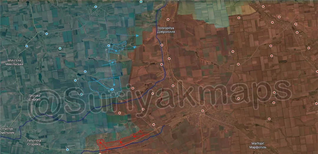
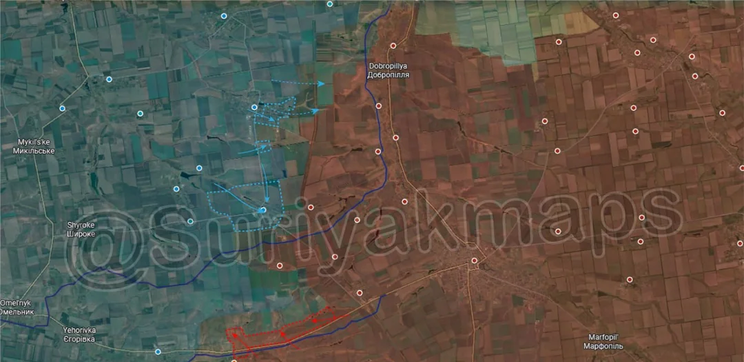
To the west clashes continue on all side of Dobropillya, with both Ukraine and Russia attempting to infiltrate the other’s lines, although with no reportable changes at this moment.
Ukrainian Forces Advance: 16.08 km²

Top Right Advance = 11.49km2, Middle Advance = 4.59km2

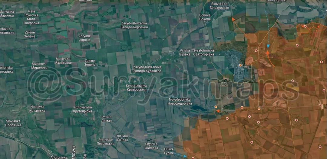
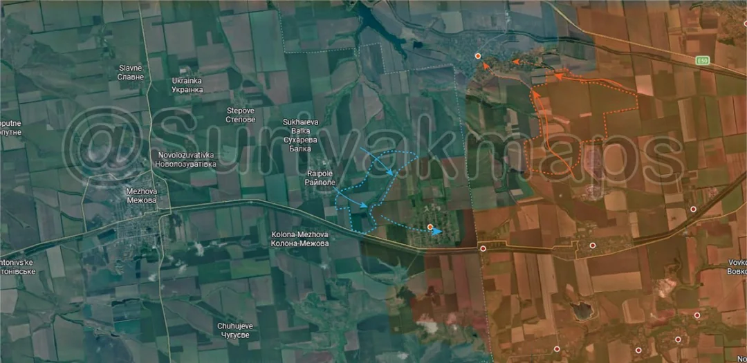
Down south, Russia has stepped up its attacks on Serhiivka, reaching the outer streets of the locality after capturing the nearby treelines.

At the same time to the southwest Ukraine pushed back the Russian attack on Raipole from mid-August and have counterattacked, shifting the fighting back into Novopidhorodne.
Ukrainian Forces Advance: 35.77 km²

Advance = 35.77km2

Heading to the Novopavlivka front, throughout September Ukraine maintained their attacks across the Solena River and from the town itself, recapturing a number of fields outside the locality and the village of Filiya.
Ukrainian Forces Advance: 21.82 km²

Advance = 21.82km2

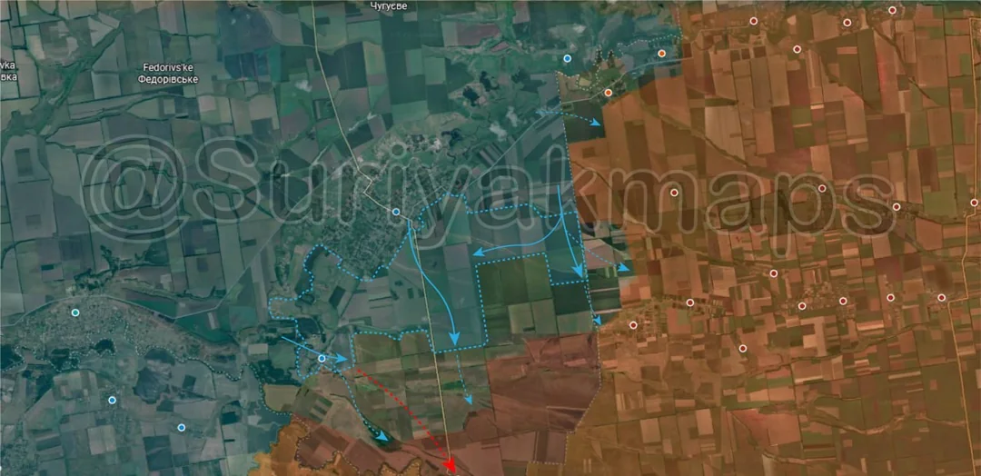
Moving to the Pokrovske front, Ukraine continued to push south from their recently captured area, taking over a number of fields and approaching the village of Maliivka. They also have been sending some DRGs east towards Fedorivka and Vesele, probing the Russian defences.
Context

No Advance

West on the same front, Russia and Ukraine continue to try infiltrate each other positions near the Yanchur and Haichur Rivers, with no confirmable changes in control.
Ukrainian Forces Advance: 3.09 km²

Middle Left Advance = 3.09km2

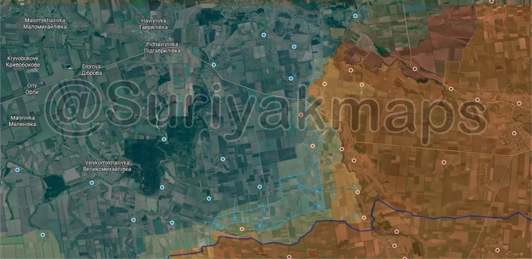
Over on the Hulyaipole front, Ukraine has continued its attacks and reportedly retaken the localities of Vozdvyzhivka and Verkhnya Tersa. As I mentioned last week this is debateable as we are still getting geolocations of Russians in and around these villages, so more of this is likely greyzone/mixed control than Suriyak shows here.

A little to the south Russia took over some treelines west of Zaliznychne, although they have been operating along here for months so it changes little for this front.
Russian Forces Advance: 33.93 km²

Top Right Advance = 13.86km2, Middle Advance = 5.13km2, Lower Right Advance = 10.52km2, Right Advance = 1.16km2, Far Right Advance = 3.26km2

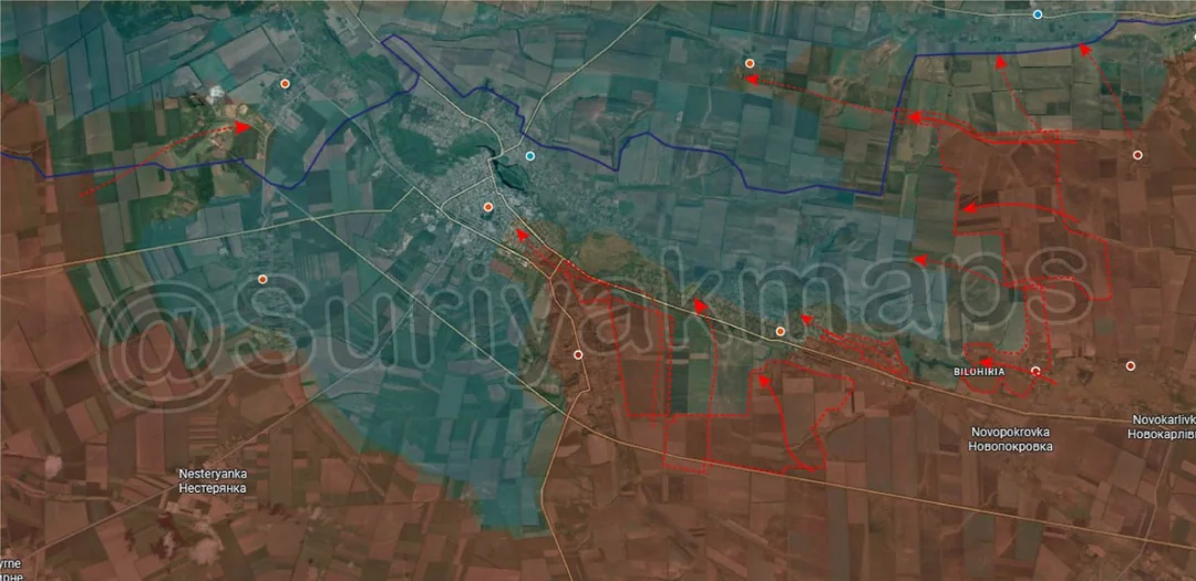
Swinging out west to the Orikhiv front, there have been a number of larger changes here as Ukrainian defences have potentially started to buckle. On the east side, Russian attacks through the fields between the Zherebets and Konka River have led to a large expansion in the greyzone and many treelines coming under their control, as well as recapturing the village of Bilohirya. The Russians also made it all the way to Chervona Krynytsya and claimed to have captured it, although for now Suriyak has only moved it into greyzone.

To the southwest, Russia has also been increasing assaults in and south of Mala Tokmachka, taking over many of the fields. Suriyak is being incredibly conservative with the mapping of the town, as we have geolocations showing the Russians present in practically every street (video 1, video 2). Whilst some Ukrainian soldiers likely still remain hiding in basements their control of the locality is minimal, as Russia has been sending soldiers straight through the middle of the town and into Orikhiv for over a month now. Combined with Novodanylivka Russia has two routes from which they are reinforcing the troops assaulting Orikhiv.

To the northwest, Russian assault groups have now entered Novopavlivka, threatening to cut off the rear of Orikhiv. If this sounds familiar, I mentioned this likely happening back in early August, and it will be key to a successful Russian siege on Orikhiv. Without those rear supply roads Ukraine will have no chance of holding Orikhiv, as they will be stuck with only drone-based supply and forced to cross the Konka River if they want to retreat.
Russian Forces Advance: 16.35 km²

Lower Left Advance = 10.12km2, Bottom Left Advance = 6.23km2