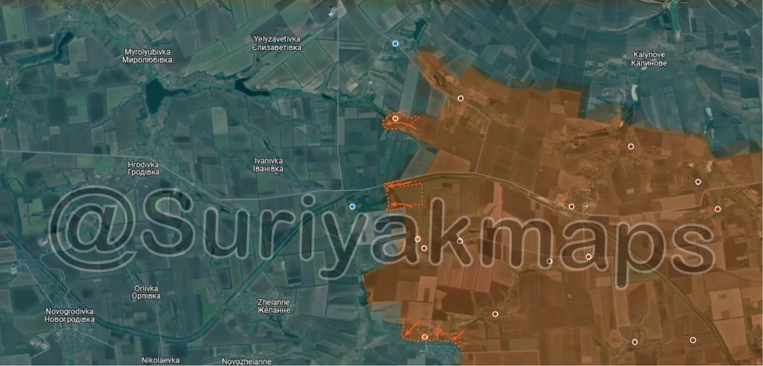
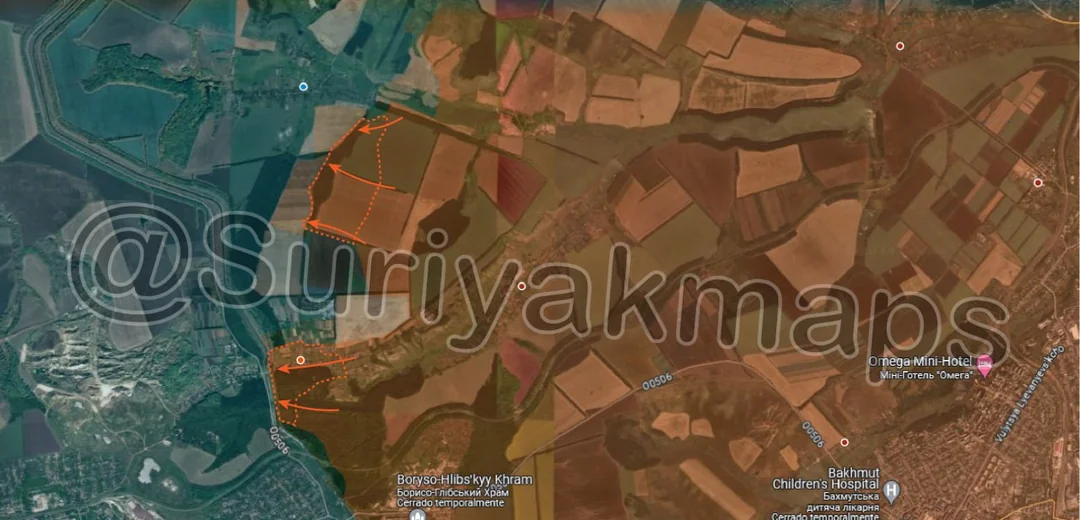
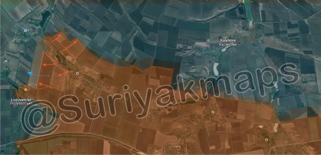
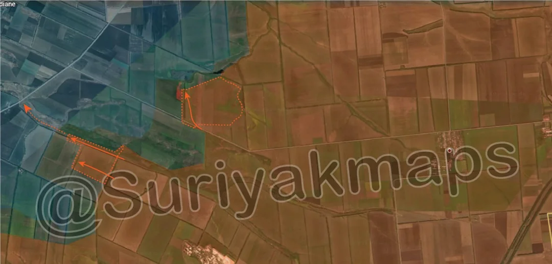
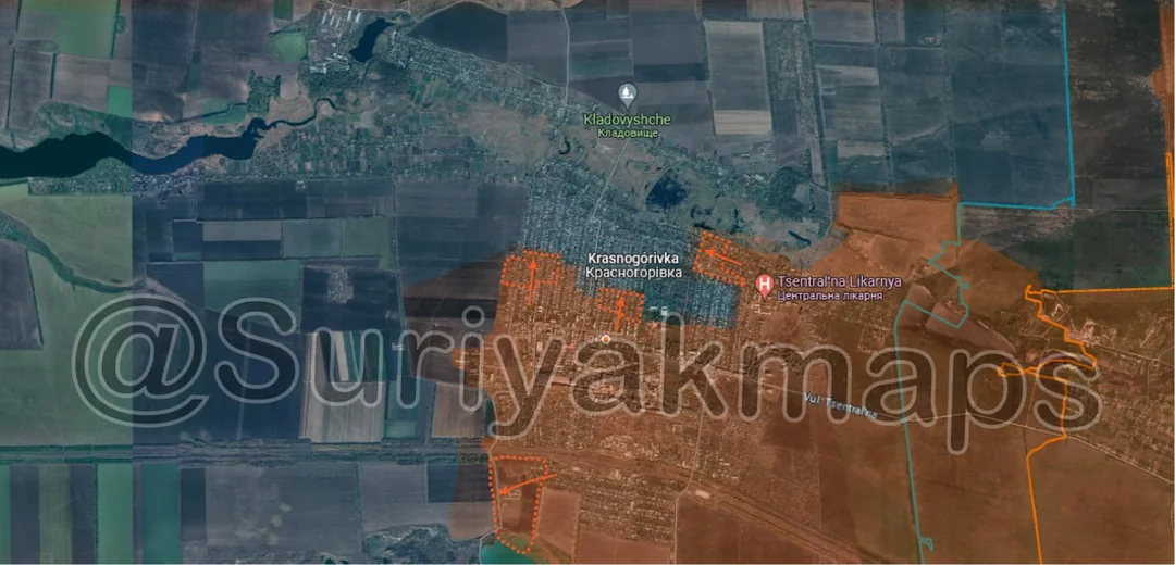
Back home
Post #65

RU POV: Russian and Ukrainian advances from Day 872 to 874 of the War - Suriyakmaps

Jul 15, 2024 — Jul 17, 2024 War Day 872–874

Picture 1 is from Day 872, Pictures 2 and 3 are from Day 873, and Pictures 4 to 9 are from Day 874.

Ukrainian Advance
0.28 km²
Overall (set): 0.28 km²
Russian Advance
11.68 km²
Net Change
-11.40 km²

Situation Snapshots

Imagery, commentary, and territorial changes from the period.

10 entries
Russian Forces Advance: 0.69 km²

Left Advance = 0.13km2, Middle Advance = 0.08km2, Right Advance = 0.10km2, Bottom Left Advance = 0.38km2

The Russian takeover of Krasnogorivka continues. In the southwest side of the town, the Ukrainian counterattack mentioned in my previous post has already been undone, with Russian forces quickly recapturing the houses and farm complex. In the centre and northern side of the town, Russian forces are moving forward, clearing street by street. The few Ukrainian forces still east of the park will likely have to retreat within the next day, or risk being encircled due to the Russian advance to their north.
Russian Forces Advance: 3.05 km²

Top Advance = 0.54km2, Middle Advance = 1.42km2, Bottom Advance = 1.09km2

On the Ocheretyne front, Russian forces managed to push over the Kazenyi Torets river, and capture Lozuvatske (a farm, not a village as some sources have said). Just to the south, Russian forces captured the first of the forest areas east of Prohres (middle blue dot), and are closing in on the main Ukrainian defence line.

At the bottom of the map, the situation for Ukrainian forces in Novoselivka Persha has gone from bad to worse. Russian forces have quickly taken over the northern side of the town, up to the river, which has led to some Ukrainian squads being captured or cut off, as can be seen in this video. For the south side of the town, Russian forces are trying to advance in from the east, with the Ukrainian 47th Brigade desperately trying to hold their lines long enough to evacuate equipment, ammunition and supplies (as this town was their forward operating base for the past few months).
Ukrainian Forces Advance: 0.10 km²

Advance = 0.10km2

In Niu-York, Ukrainian forces, bolstered by reinforcing units, counterattacked, recapturing 2 streets on the southwest side of the town. Russian forces are still trying to advance towards the centre of the town, and also up the main road (just above the r).
Ukrainian Forces Advance: 0.18 km²

Left Advance = 0.18km2

In Hlyboke, Ukrainian forces pushed north from the warehouses to capture the trenchline on the other side of the road. Simultaneously, Russian forces pushed back on the eastern side, recapturing one of the warehouses.
Russian Forces Advance: 0.14 km²

Advance = 0.14km2

Russian forces made a small advance south of Stepova Novoselivka, pushing along the railway.
Russian Forces Advance: 0.08 km²

Advance = 0.08km2

Russia cleared and captured the treeline and trenchline on the west side of Rozdolivka, following their capture of the village.
Russian Forces Advance: 1.62 km²

Top Advance = 1.04km2, Bottom Advance = 0.58km2

Russian forces managed to advance across the fields south of Hryhorivka, capturing some trenches and the forested area just south of the village. These assault groups will likely push west over the next few days, capturing the next forest area, before beginning an assault on the town from the south side.

In Kalinina, with Ukraine losing control over the micodistrict, they were forced to retreat from the eastern side of the village and the forest, ceding the area to Russia. Russian forces now control the eastern side of the canal on a 6.2km wide area, and will likely look to cross it in the coming weeks (after bombardments and planning of course). The situation in the farm complex north of Kalinina is a bit unclear, as whilst Russian forces have yet to confirm capture of it, it is highly unlikely any Ukrainian forces are still there due to the risk of being cut off. Thus, Russia will likely control of the farm within the next day or 2, once they have cleared the area.
Russian Forces Advance: 2.65 km²

Top Advance = 0.93km2, Bottom Advance = 1.72km2

Following on from picture 2, with the capture of Lozuvatske, Russian forces were able to advance west from Novooleksandrivka, capturing several fields. On the other side of the town, Russian forces expanded the buffer around the river, taking several more fields here as well.

Russian forces now have a much wider surface area to launch assaults on Vozdvyzhenka from, which is the last village before the H-32 highway. The village and area to the south area being defended by the Ukrainian 110th Mechanized Brigade and 111th Territorial Defense Brigade. The former has suffered many losses since the fall of Ocheretyne a few months ago, and from the retreat in Novooleksandrivka, whilst the latter is a poorly equipped unit that has not received much training. Thus, it is uncertainly whether these 2 units will be able to hold Vozdvyzhenka and prevent Russian from reaching the important highway.
Russian Forces Advance: 3.33 km²

Top Advance = 2.20km2, Bottom Advance = 1.17km2

Russian forces made new advances east of the O0532 road, capturing several more fields. One Russian IFV actually managed to make it almost up to the road, as seen in this video, however was destroyed shortly after, and the surviving crew would certainly not be able to consolidate any positions there. The video does however demonstrate the thin Ukrainian lines in this area, and the ability for even individual Russian units to break through past their forward trenches.

The critical supply road for Vuhledar is the most vulnerable it has ever been, and Russian forces may be able to reach it within the next few weeks.

---------------------------------------------------------------
Russian Forces Advance: 0.12 km²

Right Advance = 0.12km2