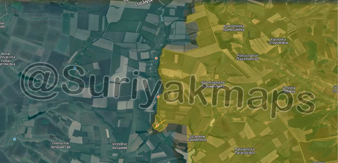
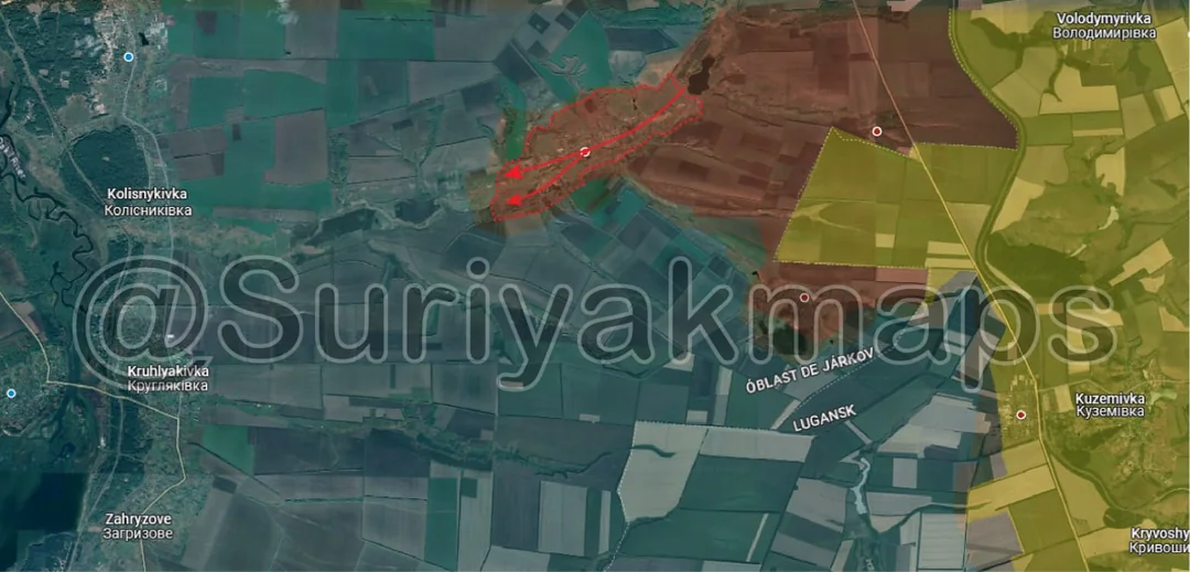
Back home
Post #66

RU POV: Russian advances from Day 877 of the War - Suriyakmaps

Jul 20, 2024 — Jul 20, 2024 War Day 877–877

A reminder that these maps are confirming updates from previous days (i.e. 12 to 24 hours delayed).

Ukrainian Advance
0.00 km²
Russian Advance
10.53 km²
Net Change
-10.53 km²

Situation Snapshots

Imagery, commentary, and territorial changes from the period.

7 entries
Russian Forces Advance: 0.97 km²

Advance = 0.97km2

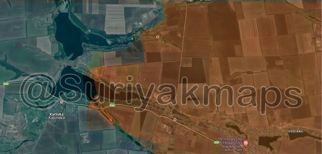
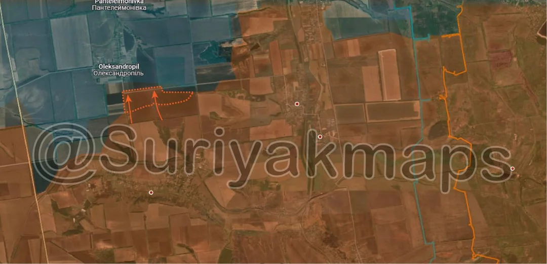
Southwest of Niu-York, Russian forces started an advance towards Oleksandropil, capturing a couple of small trenches just to the south of the village. With the focus of both sides in this area being on the fighting in Niu-York, these Russian forces likely saw an opportunity to pressure Ukraine and capture the village.

Ironically, I recently mentioned the Ukrainian 109th Territorial Defence Brigade was unlikely to see much action in the fight for Niu-York, as it is not very well equipped, and had to hold this area in case of Russian attacks, which has now come true.
Russian Forces Advance: 0.36 km²

Top Advance = 0.15km2, Middle Advance = 0.07km2, Bottom Advance = 0.14km2

Over the past few days, Russian forces have made slight advances east of Karlivka, capturing a small section of field in the north, and parts of the treelines to the east. Ukrainian forces in this area are holding within the town itself, and are not contesting these treelines. An assault on Karlivka is unlikely at this stage, as these advances have been carried out by small recon groups probing probing for positions and clearing the trees.
Russian Forces Advance: 1.24 km²

Advance = 1.24km2

Russian forces restarted their advances south of Heorhiivka, capturing a chunk of the fields. Russian troops in this area have been mostly static over the past month, recovering following their full capture of the town.
Russian Forces Advance: 0.79 km²

Left Advance = 0.04km2, Right Advance = 0.75km2

In Krasnogorivka, Russian forces have made a series of advances this week, capturing the central park and a large proportion of the remaining residential area. The fighting has now mostly turned into a 'mop-up operation', as individual Russian tanks hit Ukrainian positions in the houses, followed up by small squads of infantry clearing the buildings afterwards. The withdrawal from town has not been going well for Ukrainian troops, as individual soldiers have been picked off by Russian drones and artillery, and the wounded are left behind, as shown in some particularly gruesome videos (would not recommend watching).

To reiterate what I said a few weeks ago (because some sources have been making incorrect statements); The battle for Krasnogorivka will continue for some time as the northern and northwestern suburbs are still part of the town. Progress may slow down as Ukraine will defend the riverline after withdrawing from the centre of Krasnogorivka (pic below).
Russian Forces Advance: 0.91 km²

Top Advance = 0.43km2, Middle Advance = 0.26km2, Bottom Advance = 0.22km2

Following the capture of Prohres, Russian forces have begun clearing the tree plantation area to the north of the village, advancing in on it from the north and south side simultaneously. Any Ukrainian soldiers still in that area will almost certainly retreat within the next few hours to avoid being encircled.

There is still no clear answer as to why the Ukrainian 23rd Mechanised Brigade ceded the village without a fight, and where they plan to hold from now on.
Russian Forces Advance: 0.89 km²

Advance = 0.89km2

Russian forces crossed the Zherebets river, capturing the locality of Andriivka (a group of farms). The fields between Andriivka and Dzherelne have fallen into the grey zone, as whilst Russian troops do not occupy it, Ukraine has almost certainly pulled back over the river.
Russian Forces Advance: 5.37 km²

Advance = 5.37km2

The big news item today was the Russian capture of Pishchane, as confirmed by multiple videos, including this one of a flag being raised on the north side of the town. This advance occurred with little fanfare or videos/photos, as Russian forces quickly overwhelmed/knocked out the defending Ukrainian force.

As you can probably see from the map, Russian forces now have no settlements between them and the main supply road for Ukrainian forces on this side of the Oskil river, and will likely try expand their spearhead to push towards the river over the next few weeks/months. The loss of this supply route would severely hinder Ukrainian operations on the east side of the river, although would not stop them completely as the southern side of the road would still be in use.